Blog La Niña: What It Is, causes, effects and how It differs from El Niño
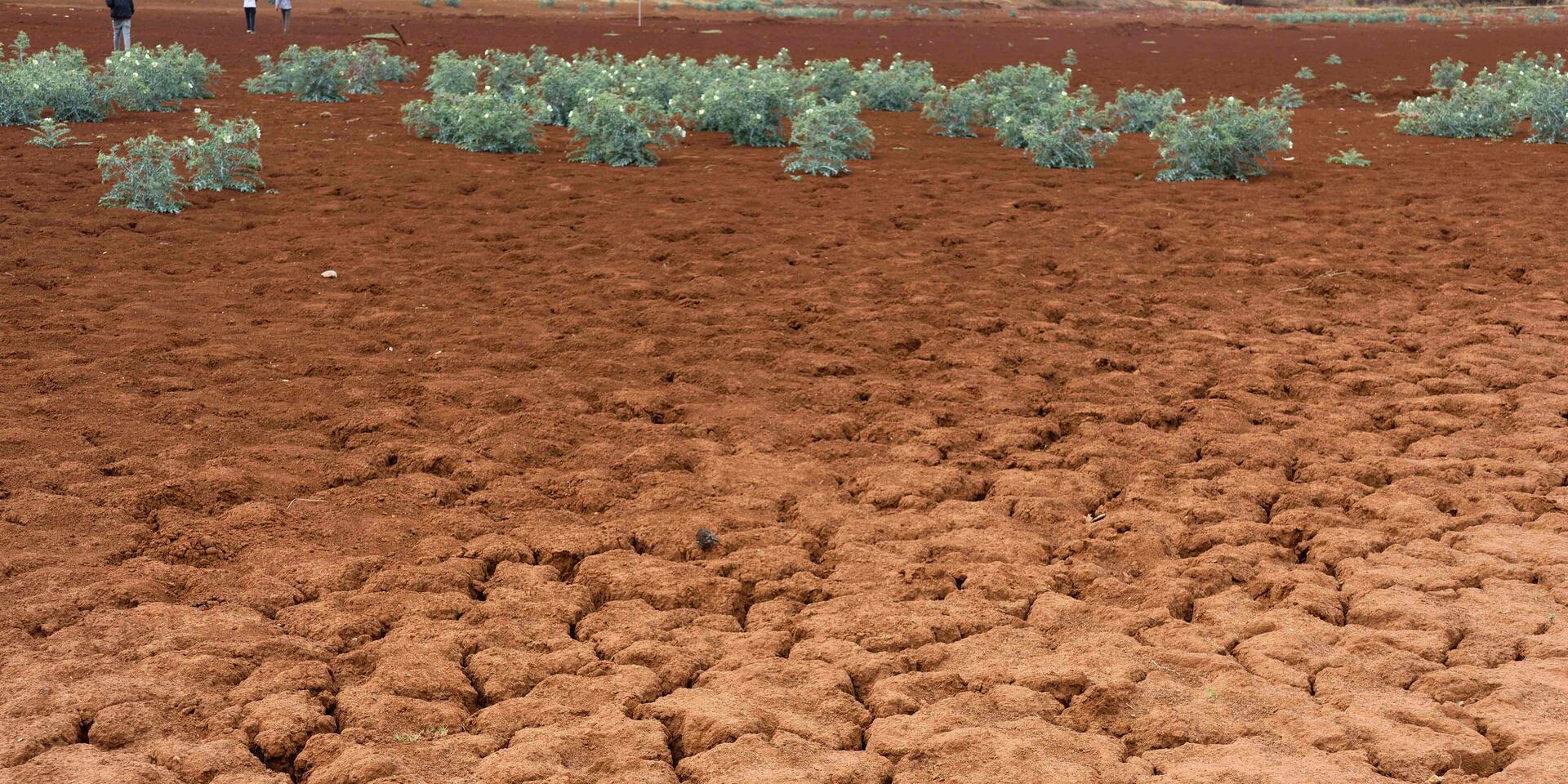

You may have heard La Niña mentioned alongside droughts, floods or changing rainy seasons. But what exactly is it, why can it bring very different weather to different parts of the world, and what does it mean for farmers and food systems?
In Eastern Africa, a farmer may watch for rains that arrive late, fall briefly or fail altogether, while pastoralists travel farther in search of water and pasture. Across parts of Asia and the Pacific, the problem can be the opposite: persistent rain, waterlogged fields and flooding. Thousands of kilometres away, across the Americas, the same climate phenomenon can shift growing seasons, alter rainfall and contribute to conditions that favour a more active Atlantic hurricane season.
The connection between these seemingly different experiences begins in the tropical Pacific Ocean, where changes in the temperature of surface waters interact with the atmosphere above them and influence winds and rainfall far beyond the Pacific. The natural climate cycle behind these changes is known as the El Niño-Southern Oscillation (ENSO), with El Niño representing its warmer phase and La Niña its cooler phase.
For agriculture and food systems, the significance of La Niña lies in what those changes can mean for growing seasons and livelihoods: whether rains arrive when crops need them, whether farmers have enough time to plant, whether pasture and water remain available for livestock, and whether heavy rainfall damages fields or interrupts access to markets.
What is La Niña, and what causes it?
La Niña develops through an interaction between the tropical Pacific Ocean and the atmosphere above it, beginning with changes in the trade winds that move warm surface water across the equatorial Pacific.
Under normal conditions, steady trade winds blow westwards along the equator, pushing warm surface water from the Americas towards Asia. As warm water moves west, colder, nutrient-rich water from deeper in the ocean rises towards the surface near the western coast of South America through a process known as upwelling.
During La Niña, the trade winds become stronger, pushing more warm surface water towards the western Pacific and allowing more cold water to rise near South America. The central and eastern tropical Pacific consequently become cooler than average. During El Niño, the opposite tends to happen: the trade winds weaken, upwelling is reduced and warmer surface water spreads farther east.
Scientists also look for corresponding changes in winds, rainfall and atmospheric pressure because ENSO involves both the ocean and atmosphere. As the distribution of warm and cool water across the Pacific changes, the areas where warm, moist air rises and tropical rainfall develops can shift. Through long-distance climate connections known as teleconnections, changes in tropical atmospheric circulation can influence rainfall patterns around the world.
La Niña increases the likelihood of particular weather conditions rather than determining exactly what will happen in any one place. Other oceans, atmospheric systems, seasons and local geography continue to influence regional weather.
How long can La Niña last?
El Niño and La Niña generally occur at irregular intervals of roughly two to seven years, with individual episodes commonly lasting around nine to twelve months. La Niña can sometimes persist across consecutive years, affecting rainfall and agricultural conditions over more than one growing season.
In Colombia's Sogamoso River Basin, research on the multiyear La Niña events of 1998-2000 and 2010-2012 found that interactions between ENSO and other modes of climate variability helped prolong rainfall, including during 2010-2012 when rainy conditions extended over much of Colombia.
The strength and duration of individual events vary, as do their interactions with other climate systems, which can produce different regional outcomes from one La Niña to another.
La Niña vs El Niño: What's the difference?
La Niña and El Niño are opposite phases of the same climate system rather than separate phenomena. Their differences begin in the tropical Pacific but can eventually be reflected in rainfall, temperature, storms and growing conditions around the world.
|
|
La Niña |
El Niño |
|
Pacific Ocean |
The central and eastern tropical Pacific is cooler than usual. |
The central and eastern tropical Pacific is warmer than usual. |
|
Trade winds |
Usually stronger |
Usually weaker |
|
Upwelling near South America |
Stronger
|
Weaker
|
|
Atlantic hurricanes
|
Conditions can become more favourable. |
Activity is often suppressed. |
|
Duration |
Can persist across multiple years |
Less commonly persists across multiple years |
Periods when neither phase dominates are known as ENSO-neutral conditions.
The effects on agriculture depend on when and where these changes occur. Additional rainfall can benefit crops in water stressed regions but cause damage when it leads to flooding, while drier conditions may favour harvesting but threaten crops during germination or flowering.
Global effects of La Niña
Changes in tropical Pacific temperatures and atmospheric circulation influence weather across several continents. The regional patterns associated with La Niña have been observed over many decades, although their strength and geographic extent differ between events.
Africa: One continent, different rainfall risks
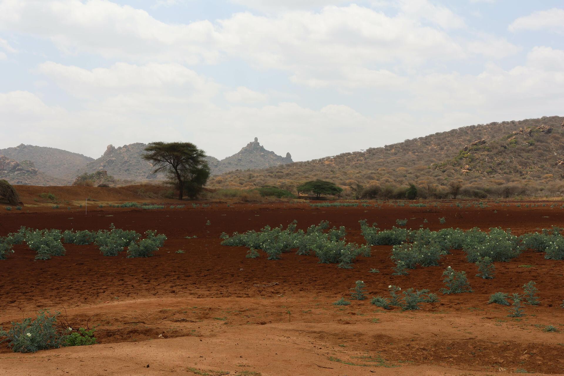
Across equatorial Eastern Africa, including parts of Kenya, Ethiopia, Somalia, Uganda and Tanzania, La Niña is often associated with a greater likelihood of below-average rainfall during the October–December short rains.
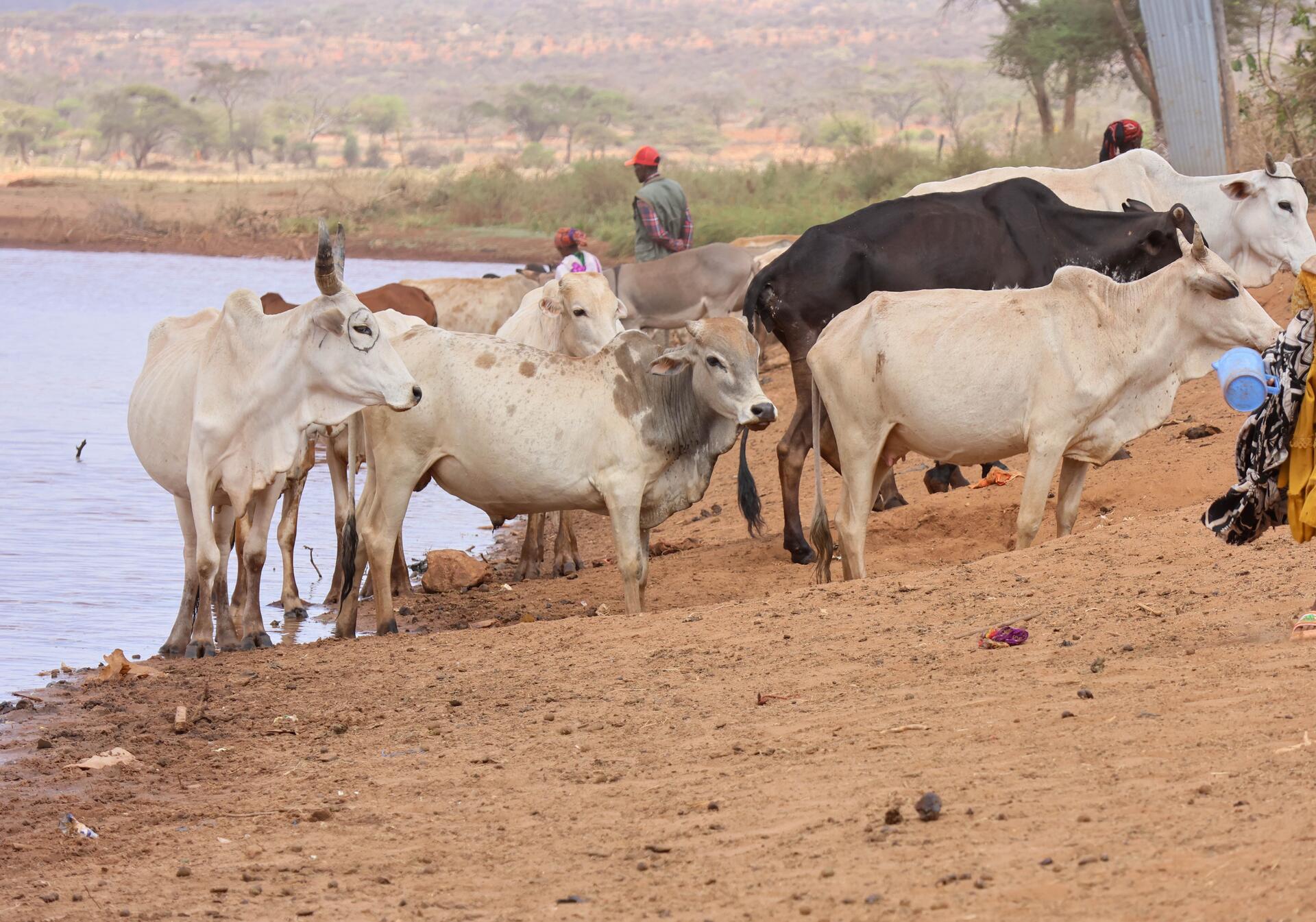
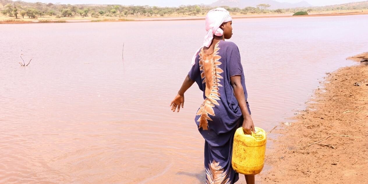
When those rains underperform, the consequences can move quickly through agricultural and pastoral systems in the Horn of Africa: crops struggle to establish, water sources shrink, pasture deteriorates and livestock may have to travel farther for feed and water.
Recent Alliance research from Ethiopia's lowlands gives a sense of what deteriorating water and pasture conditions can mean on the ground. A comparison of conditions between January 2025 and January 2026 found that the number of seasonally dry and near-dry water points had doubled, while pasture shifted towards low and very low biomass, increasing risks for livestock production, food security and competition over natural resources. The research documents the pressures associated with deteriorating rangeland conditions without attributing those changes solely to La Niña.
Conditions in the Indian Ocean and other regional climate systems can reinforce or counteract the Pacific signal, and ENSO's influence differs by season. Regional and national seasonal forecasts are therefore essential for understanding how a particular La Niña event may affect Eastern Africa.
Farther south, parts of Southern Africa often have a greater likelihood of above-average rainfall during La Niña. That can improve soil moisture, pasture and water storage, but excessive rainfall can also waterlog crops, erode soils and damage roads and other infrastructure.
Asia and the Pacific: When more rain is not always good news
Across parts of Southeast Asia, Australia and the western Pacific, La Niña commonly increases the likelihood of wetter-than-average conditions. Additional rainfall can replenish water supplies and support crops after dry periods, but persistent or intense rain can also flood fields, delay harvesting and increase crop disease.
Agricultural research in the region has shown how ENSO forecasts can help anticipate changes in crop production. In Indonesia, Alliance research on cacao production found that ENSO conditions explained 75% of the variation in yields among the farms studied, with useful predictions possible as far as 25 months before harvest. The findings suggest that information about ocean and atmospheric conditions could help farmers and agricultural services anticipate production risks well before a crop reaches harvest.
Research in Nepal's Terai similarly found a relationship between ENSO, seasonal rainfall and rice production and explored how ENSO information could be combined with crop modelling to evaluate management options before planting.
La Niña also affects life beneath the ocean's surface, particularly in the eastern Pacific, where stronger upwelling brings colder, nutrient-rich water to the surface. These nutrients support plankton growth and the marine food webs on which fish populations depend, while changes in ocean conditions can influence fisheries productivity and the livelihoods of coastal communities.
The Americas: Rainfall is also about timing
Across the Americas, La Niña can bring contrasting rainfall conditions, with parts of southern Brazil and Argentina more likely to experience dry weather during certain seasons, while northern South America may receive above-average rainfall. For agriculture, the timing and distribution of that rainfall can be just as important as the total amount received, particularly when farmers have a limited window in which to plant their crops.
Research using daily rainfall records from 50 weather stations across Central Brazil found that the optimal sowing window was shorter during La Niña years across much of the study region, leaving farmers with less time to plant under favourable conditions. This can be particularly challenging in areas where crop production depends heavily on seasonal rainfall.
In North America, La Niña winters are commonly associated with warmer and drier conditions across parts of the southern United States and cooler or wetter conditions farther north. La Niña can also create conditions that favour a more active Atlantic hurricane season by reducing vertical wind shear that might otherwise disrupt developing storms, although it does not cause individual hurricanes.
How La Niña affects agriculture and food security
For agriculture, the effects of La Niña depend on where rain falls, how much falls and when it arrives. A rainfall deficit around planting can delay germination or force farmers to replant, while drought during flowering or grain filling can reduce yields. Too much rain can flood fields, erode fertile soil, increase some pests and diseases and make roads impassable when produce needs to reach markets.
For livestock keepers, the consequences of an unusually dry season can extend well beyond the immediate shortage of water. As grazing areas deteriorate and reliable water sources become harder to find, pastoralists may have to move their herds over longer distances, increasing pressure on animals and the limited resources available to communities. In regions expecting above-average rainfall, flooding can restrict access to grazing areas, disrupt livestock movement and increase disease risks.
When droughts or floods damage crops and disrupt transport, the consequences can reach markets and households far beyond the affected farms. Reduced food supplies and rising prices can make it harder for families to afford essential foods, particularly in communities already struggling with food insecurity.
Because El Niño and La Niña can often be anticipated months ahead, seasonal climate forecasts can help farmers and agricultural institutions prepare for potential droughts, floods and other weather-related risks. Their usefulness, however, depends on whether the information is timely, locally relevant and accompanied by practical advice that farmers can act on.
A 2025 Alliance-hosted study involving 1,212 farmers in Burkina Faso, Ghana, Mali and Senegal found that 62% considered weather-based information critical to their decision-making. Farmers showed particularly strong interest in services that combined weather information with practical agricultural and risk-management options, highlighting the importance of advice that responds to the decisions farmers actually face.
Is climate change changing La Niña?
La Niña is a natural part of the El Niño-Southern Oscillation (ENSO), but it is now occurring in a world that is considerably warmer than in the past. Scientists are investigating how global warming may influence future ENSO events, particularly whether it could change their frequency, intensity or duration. There is still considerable uncertainty about these changes, partly because ENSO varies naturally over decades and climate models do not agree on how all aspects of the cycle will respond to warming.
There is stronger evidence that climate change can intensify some of the weather extremes associated with ENSO. Warmer air can hold more moisture, increasing the potential for heavy rainfall when conditions favour storms, while higher temperatures can worsen drought impacts by increasing evaporation and the demand for water. A La Niña event occurring today may therefore unfold under very different environmental conditions from a similar event several decades ago, even if the underlying Pacific Ocean patterns are comparable.
For agriculture, understanding these overlapping risks is increasingly important when planning for future growing conditions. The Alliance's ACLIMATAR climate adaptation planning tool supports this work by assessing climate-related risks to crops and identifying adaptation options suited to different agricultural contexts.
How scientists predict and track La Niña
Scientists track La Niña by measuring changes in ocean temperatures and atmospheric conditions across the tropical Pacific. Satellites, ocean buoys and other observing systems provide continuous information about sea-surface temperatures, while instruments beneath the surface detect changes in the distribution of warm and cold water that may signal an approaching event.
One important monitoring area is the Niño 3.4 region in the central Pacific. Scientists compare temperatures there with historical averages and examine whether cooling is accompanied by stronger trade winds and changes in atmospheric pressure and rainfall. NOAA has traditionally used a threshold of 0.5°C below average as an important indicator of La Niña conditions, although its official monitoring now uses a relative temperature index that accounts for warming across the tropical oceans.
These observations are combined with computer models that simulate how ocean and atmospheric conditions may evolve over the coming months. The NOAA Climate Prediction Center and the World Meteorological Organization publish regular outlooks estimating the likelihood of La Niña, El Niño or neutral conditions, along with their possible development and duration.
Forecasts are generally more reliable over shorter lead times, with a well-known reduction in predictability during Northern Hemisphere spring. Rather than offering a definite prediction, scientists express the likelihood of each ENSO phase as a percentage and revise their assessments as new observations become available.
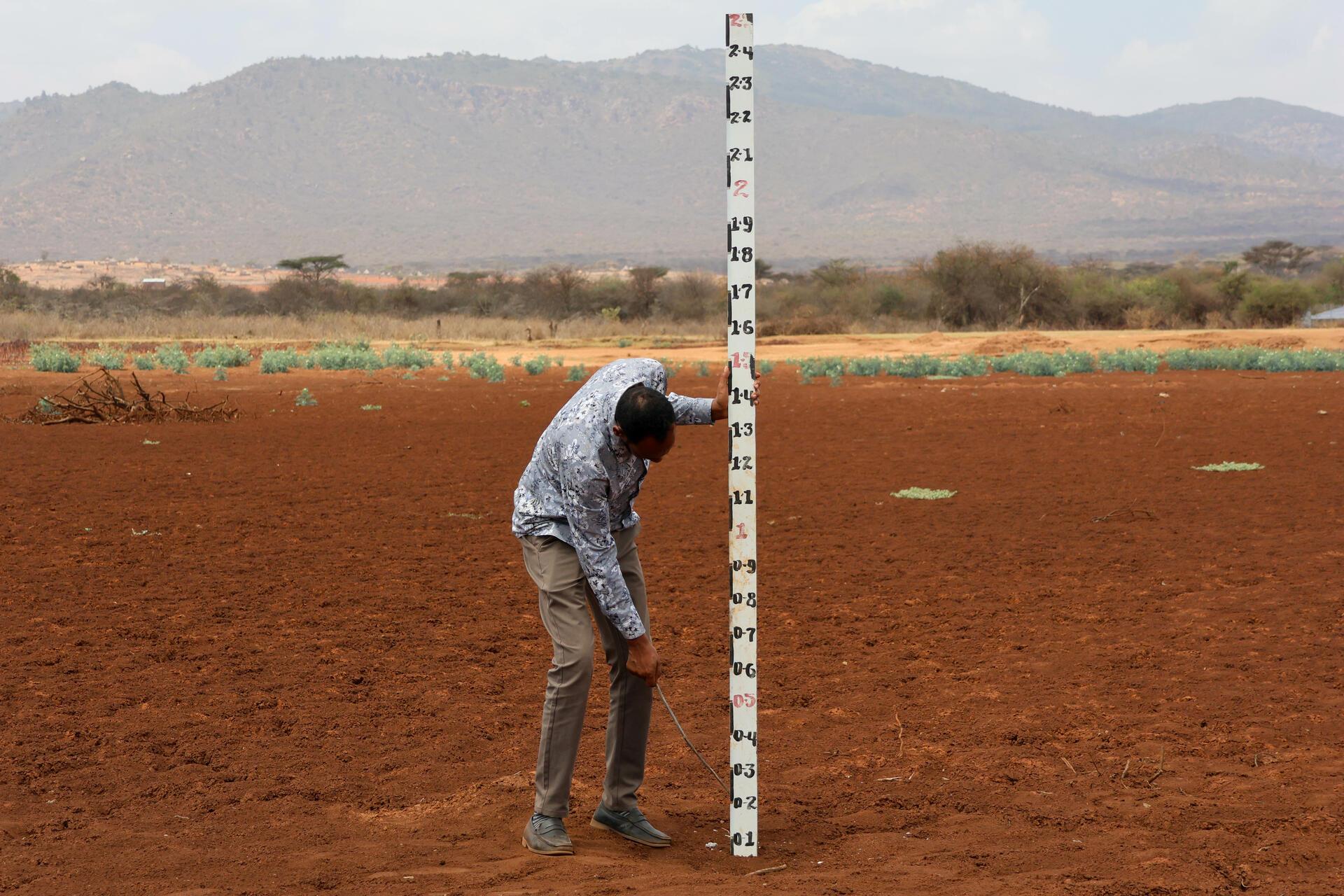
From a La Niña forecast to a farmer's decision
Knowing that La Niña is developing does not tell a farmer whether to plant next week, choose a shorter-season crop variety or move livestock to another grazing area. Farmers need information about the expected start and distribution of rainfall in their area, interpreted alongside agricultural conditions and the decisions they are preparing to make.
In Kenya, Participatory Scenario Planning brings meteorological information together with agricultural expertise and local knowledge to interpret seasonal forecasts and develop advisories relevant to specific communities. Improved Participatory Scenario Planning processes across nine Kenyan counties directly reached more than 328,000 community stakeholders, with an estimated 1,000,600 people reached indirectly with climate information for seasonal planning.
Other approaches are strengthening the link between forecasts and agricultural extension. Recent digital climate advisory work in Kenya is connecting meteorological services, agricultural knowledge, digital platforms and Farmer Field Schools so that information can be interpreted and delivered closer to the people making decisions.
In Uganda's Hoima District, local agricultural advisory platforms reviewed a forecast indicating delayed rainfall and recommended that farmers postpone planting by approximately two weeks and prioritize early-maturing bean varieties suited to a shorter growing season. The resulting advice was shared through extension networks and local radio.
Pastoral systems require information that reflects how communities manage water, pasture and livestock movement. In Ethiopia and along the Kenya-Ethiopia border, Alliance-supported climate and rangeland monitoring combines forecasts, satellite information and field observations to help communities and authorities understand changing conditions and make earlier decisions about livestock movement and resource management.
In Ethiopia's Borana pastoral areas, researchers and partners have also used radio to make technical information more accessible. A water and pasture monitoring initiative developed an Afan Oromo radio programme that translated monitoring information into locally relevant advisories, with broadcasts and related dissemination channels reaching more than 500,000 pastoralists and agro-pastoralists.
How can farmers and communities prepare for La Niña?
There is no single La Niña preparedness plan because the appropriate response depends on what the seasonal forecast indicates locally.
Where drier conditions are expected, farmers may consider adjusting planting dates, choosing drought-tolerant or early-maturing varieties, conserving soil moisture and securing water or livestock feed. Where wetter conditions are more likely, priorities may include improving drainage, protecting harvested crops, preparing for crop diseases and identifying fields or infrastructure vulnerable to flooding.
The most effective approaches combine climate information with realistic options for action. Alliance work on tailored climate information services across the Philippines, Guatemala, Senegal and Kenya demonstrates how forecasts can be interpreted through local agricultural systems rather than distributed as generic information.
Even when reliable climate forecasts are available, many farmers face barriers to accessing and using them. An Alliance assessment of climate-service systems in Kenya and Nigeria identified challenges ranging from limited local-level data and high connectivity costs to language barriers, low digital literacy and inadequate technical support. These challenges can prevent farmers from receiving timely, relevant information when they need it to make decisions about their crops and livelihoods.
For communities facing increasing climate risks, preparedness depends on having reliable forecasts, practical advice and enough time and resources to act before droughts, floods or other weather-related disruptions threaten livelihoods.
Frequently asked questions about La Niña
Does La Niña always cause drought?
No. La Niña increases the likelihood of dry conditions in some regions and wetter conditions in others. Other climate systems and local conditions also influence the outcome, which is why regional seasonal forecasts are more useful than assuming La Niña automatically means drought.
Does La Niña mean colder weather?
Not necessarily. The “cool” in La Niña refers to cooler-than-average surface waters in the central and eastern tropical Pacific, not to the whole planet becoming colder. Temperatures over land can be warmer or cooler than usual depending on the region and season.
Does La Niña mean more rain?
It depends on where you are. Parts of Southeast Asia, Australia and Southern Africa often have an increased likelihood of wetter conditions, while other regions can become drier. Managing these contrasting rainfall risks requires different agricultural responses.
Does La Niña cause drought in Kenya and Eastern Africa?
La Niña is often associated with a greater likelihood of below-average October–December short rains across equatorial Eastern Africa, including parts of Kenya, but it does not guarantee drought. Indian Ocean conditions and other regional climate drivers can strengthen or weaken that relationship.
Can La Niña and El Niño happen at the same time?
No. They are opposite phases of the same ENSO climate cycle. The system can move from one phase through ENSO-neutral conditions and later into the other, but El Niño and La Niña cannot occur simultaneously.
Can scientists predict La Niña?
Scientists can often identify the development of La Niña several months ahead by monitoring the tropical Pacific Ocean and atmosphere and using climate models. Climate-informed agricultural advisories can then help farmers prepare for anticipated seasonal risks.
Does La Niña cause more hurricanes?
La Niña can create conditions that favour greater Atlantic hurricane activity, particularly by reducing vertical wind shear, but it does not cause individual hurricanes. Other ocean and atmospheric conditions determine whether storms actually develop.
Is La Niña bad for agriculture?
Not inherently. Its effects depend on the crop, location and season. Too little rain can delay planting and reduce yields, while too much can cause flooding, waterlogging, erosion and disease. Research on climate-resilient bean production in Kenya illustrates how agricultural systems are responding to increasing weather extremes.
Where can I check the latest La Niña forecast?
Because ENSO conditions change, readers should consult the latest NOAA Climate Prediction Center outlooks and World Meteorological Organization El Niño/La Niña updates. Regional climate centres and national meteorological agencies provide information that is more useful for understanding likely local impacts.
From the Pacific to the farm
La Niña begins with changes in the tropical Pacific Ocean, but its consequences are felt much farther away, in the timing of rainy seasons, the availability of water and pasture, the conditions under which crops grow and the choices communities make before difficult weather arrives.
Scientists cannot predict every rainfall event or agricultural outcome, but ENSO monitoring offers an opportunity to recognize changing seasonal risks early enough to prepare. When that information is combined with local forecasts, agricultural research and the knowledge of farming communities, it can help people make decisions that protect livelihoods and strengthen food-system resilience.