From the Field Forecasts across the frontier: How climate data is guiding pastoralists
In Moyale, on the Ethiopia-Kenya border, localized climate forecasts help pastoralists make timely decisions on livestock, water, and crops amid drought and erratic rain.
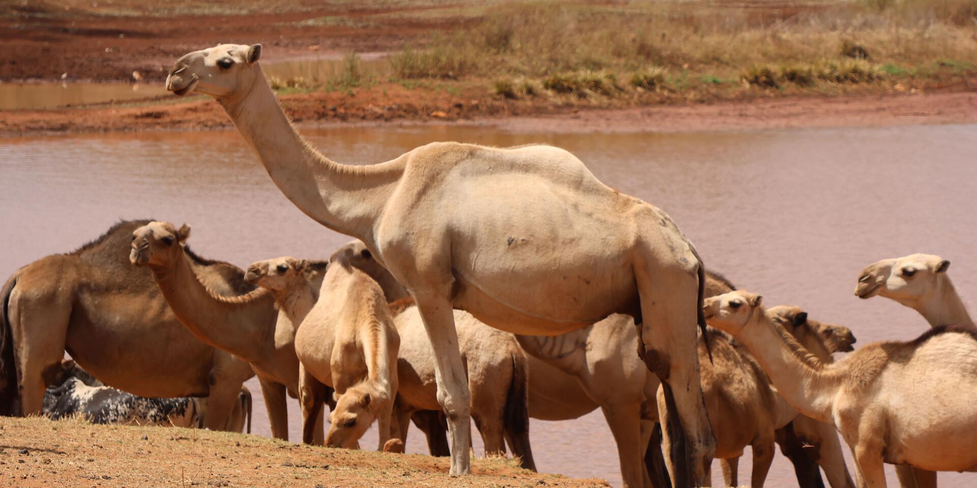
In Moyale, the border town that straddles Ethiopia and Kenya, that translation took on urgency. The March-May (MAM) 2026 forecast pointed to normal to below normal rainfall across most of the Moyale-Borana cluster, with wetter-than-normal conditions projected only in parts of northwestern areas such as Teltele and South Omo. On paper, the phrase “normal to below normal” sounds technical. In Moyale, it landed heavily. Herders and farmers, already managing fragile herds and small crop plots, felt the weight of another uncertain season. Pasture was scarce, water points strained, and families were forced to make difficult decisions about where to move livestock or whether to delay planting.
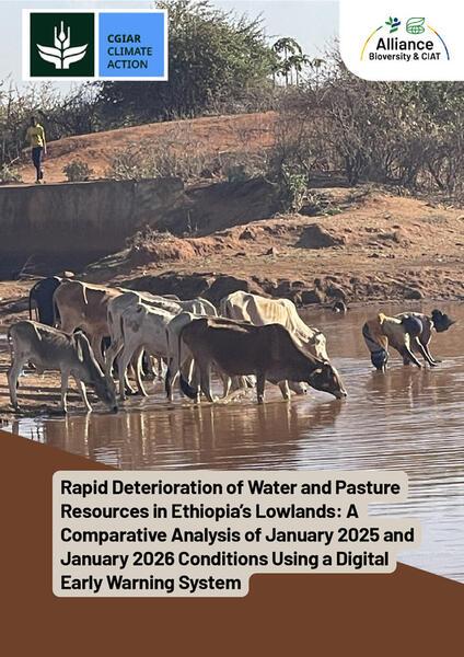
The region is emerging from consecutive droughts between 2020 and 2023, destructive floods in 2023, and a failed October–December (OND) 2025 rainy season that delivered less than 30 percent of expected rainfall in some areas. Water points have dried, boreholes are overused, pasture has thinned to dust, and the recovery windows between shocks are shrinking. The forecast therefore signals potential stress on already fragile water and pasture systems and underscores the urgent need for preparedness before conditions deteriorate further.
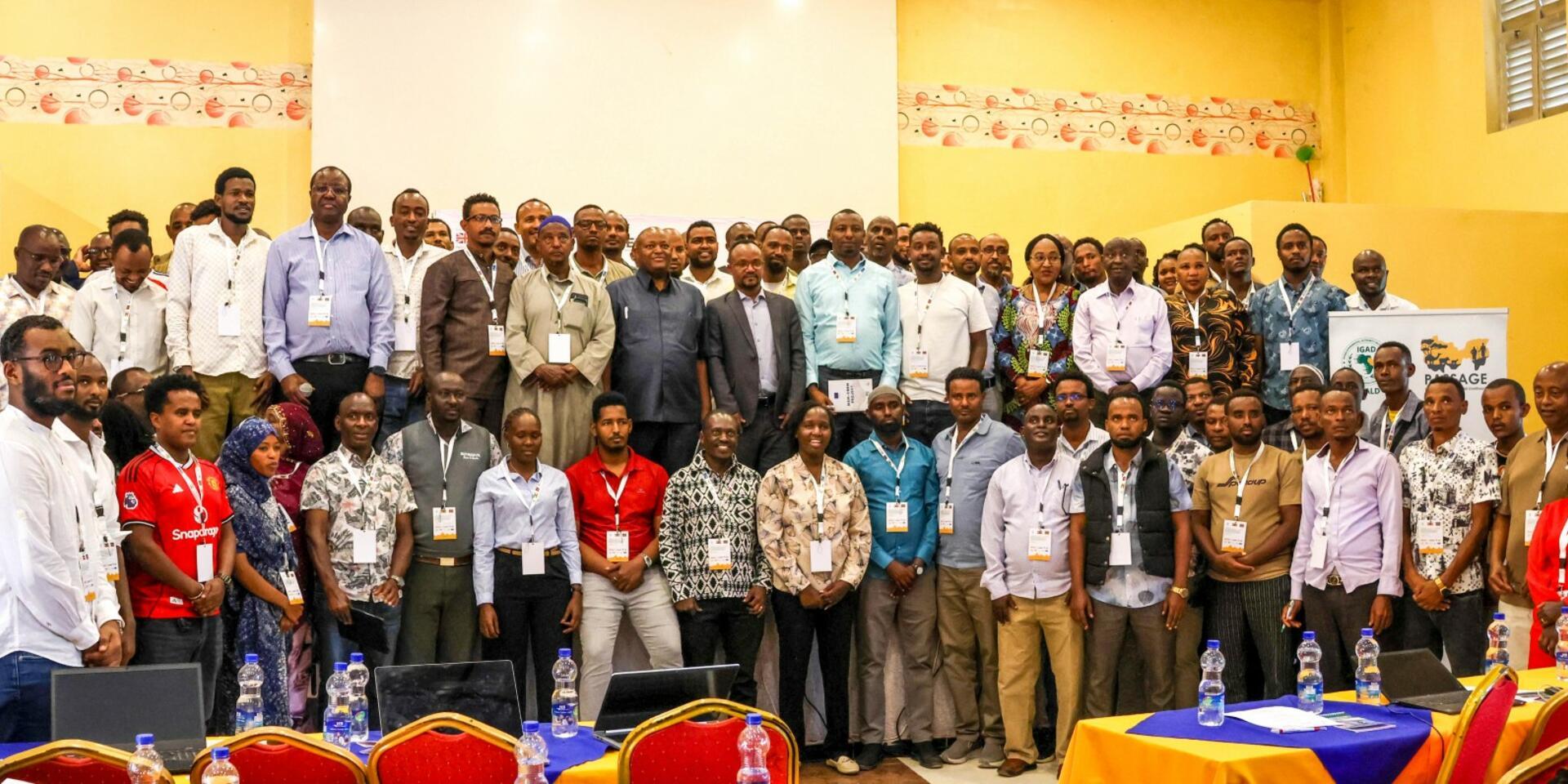
Sub-Climate Outlook Forums (Sub-COF5), organized by IGAD Climate Prediction and Applications Centre in collaboration with the Alliance of Bioversity International and CIAT, along with other partners, are designed to close a dangerous gap: the distance between regional climate forecasts and real-world decisions in the rangelands.
Sub-COF5 are localized platforms that translate and downscale regional climate information into actionable, user-centered advisories tailored to specific livelihoods and local geographies. In practice, this means taking probability maps produced at regional level and converting them into sector-specific guidance for livestock mobility, water management, cropping decisions, and conflict prevention in the very places where climate shocks are first felt.
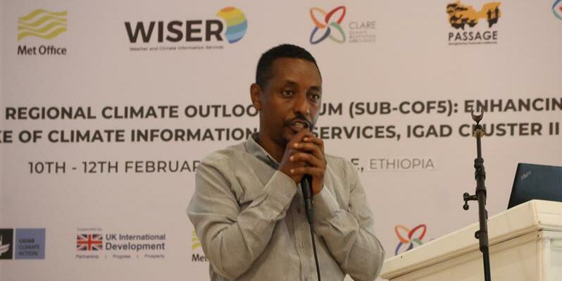
“We are downscaling climate information tailored to the local level,” Titike K. Bahaga, Climate Scientist at ICPAC, said during the 5th Sub-Regional Climate Outlook Forum in Moyale, a border town often described half in jest, half in truth, as “no man’s land”, because what happens on one side of the Ethiopia - Kenya boundary rarely stays there.
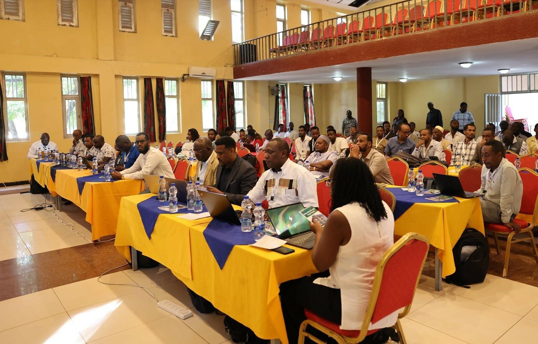
Scientists, livestock officers, Borana elders, journalists, county officials and disaster officials had gathered for the 5th SubCOF not to debate whether the climate is changing, but to confront what that change already means for grass, water, livestock, and the fragile social contracts that bind pastoral life together across the Marsabit - Borana cluster.
The Alliance in action: Science meets community needs
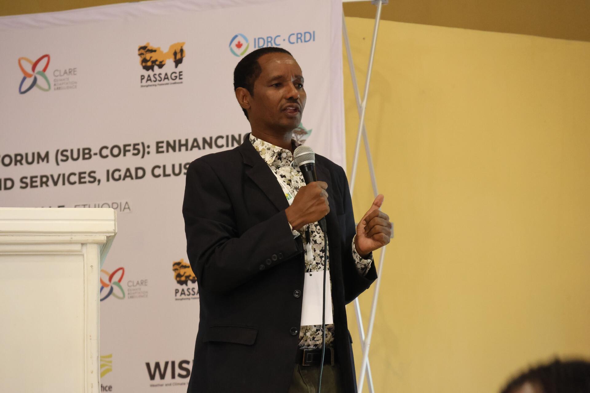
Under its CGIAR Climate Action Science Program, the Alliance of Bioversity International and CIAT plays an important role in supporting Sub-COFs by helping translate regional climate forecasts into localized, user-friendly advisories tailored to pastoral and agro-pastoral communities, while coordinating multi stakeholder engagements across sectors and borders. During the 5th SubCOF engagement in Moyale, Sintayehu Workeneh presented Ethiopia’s user-centered water and pasture monitoring and forecasting system, designed to strengthen pastoral decision making. His presentation promoted the integration of water and pasture monitoring and forecasting systems for the coproduction of SubCOF anticipatory action and advisory services, contributing to early warning and anticipatory action systems. The Alliance also plays a key role in the dissemination of the outlook, enabling communities and institutions to make informed decisions before crisis peaks.
For pastoral systems, where mobility, access to sparse natural resources, and ecosystem health determine survival, this integration is transformative. Near real time monitoring of water points, early warning alerts, and predictive outlooks are disseminated through community information centers, SMS messages, radio broadcasts, and traditional communication channels. By aligning rainfall forecasts with rangeland and water data, the system helps communities decide where, when, and how to move livestock, manage grazing routes, and prevent resource-based conflict.
The Alliance also supports dissemination of the outlook beyond the workshop hall, ensuring advisories reach local administrations, extension agents, journalists, and ultimately pastoral households themselves. Forecasts that remain in conference rooms cannot protect livelihoods. Forecasts translated into action can.
What below normal seasons mean for border communities
The normal to below-normal rainfall outlook for the MAM season has significant implications across multiple sectors in the Marsabit-Borana cluster.
Crop production may face longer dry spells, reduced soil moisture and delayed planting, affecting yields and household food availability. In practical terms, this means farmers may postpone sowing while waiting for reliable onset, risking shorter growing cycles and lower productivity, or plant early and face germination failure if rains stall. For agro-pastoral households that depend on both crops and livestock, reduced harvests translate not only into less food on the table, but also diminished income to purchase supplementary feed, veterinary services, or staple commodities during lean periods.
Livestock and water challenges in the Marsabit-Borana cluster:
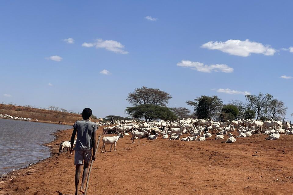
- Limited pasture and water: Animals face stress; herders must adjust grazing routes, herd size, and mobility patterns, sometimes across borders.
- Poor pasture quality: Reduces livestock body condition, lowers milk production, and weakens disease resistance.
- Urgent herd decisions: Households with smaller or less diverse herds must make more consequential choices about which animals to move, sell, or retain.
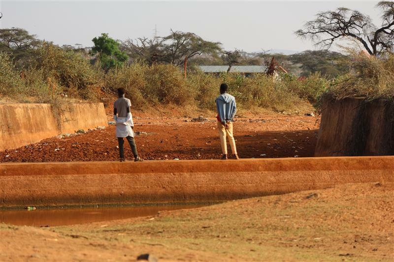
- Water scarcity and competition: Declining surface water and stressed boreholes increase tension over access, maintenance, and allocation.
- Need for anticipatory management: Real-time monitoring combined with seasonal forecasts guides rationing, rehabilitation of key water points, and contingency measures such as water trucking.
The risk of climate-induced conflict rises as communities compete over scarce water and pasture, particularly across borders, highlighting the need for coordinated resource management and early-warning mechanisms. In the Marsabit-Borana cluster, livestock mobility, shared grazing corridors, and cross-border kinship networks create interdependence. When pasture fails on one side, herds may cross into neighboring territories, increasing pressure on limited resources and, if poorly coordinated, heightening the risk of disputes. Coordinated advisories and joint monitoring between Ethiopian and Kenyan authorities therefore become critical tools not only for climate adaptation but also for peacebuilding.
Disaster risk is heightened due to potential climate induced risks or localized flooding, emphasizing the importance of anticipatory action, preparedness planning, and early warning systems to reduce losses. Even in a generally drier outlook, localized heavy rainfall events can trigger flash floods, soil erosion, and damage to infrastructure and water sources. Preparedness planning must therefore consider both deficits and extremes, ensuring that communities are equipped to respond to multiple climate risks within the same season.
Climate-related displacement may occur when extreme shortages force households to migrate in search of water, pasture, or livelihood opportunities, underlining the importance of anticipatory planning, early action, and conflict-sensitive interventions to reduce vulnerability and support community resilience. Migration in pastoral systems is often adaptive, but when driven by crisis rather than strategy, it can disrupt education, strain host communities, and erode traditional support networks. Strengthening early warning systems, improving cross-border coordination, and translating seasonal outlooks into timely advisories can reduce the likelihood that mobility becomes distress-driven displacement.
As one Kenyan representative reminded participants during the SubCOF engagement, “What happens in Kenya affects Ethiopia, and what happens on the Ethiopian side effects Kenya,” highlighting a reality that pastoralists have long understood.
The mobility of livestock, shared water points, and seasonal grazing patterns do not stop at political borders, meaning that climate shocks, resource scarcity, or conflict in one country can quickly spill over to the other. This underscores the critical need for cross border coordination and planning in anticipatory action, resource management, and early warning systems. Effective climate adaptation and disaster preparedness in the Marsabit-Borana cluster therefore require joint monitoring of water, pasture, and rangeland conditions, synchronized early warning advisories, and collaborative management of shared resources to reduce risks, prevent conflict, and safeguard the livelihoods of pastoral communities across borders. Moreover, strengthening SubCOFs and integrating user centered water and pasture monitoring systems represents a critical step toward resilient livelihoods, food security, and climate informed peacebuilding.

Through science, innovation, and inclusive engagement, the Alliance and its partners are helping pastoral and agro pastoral communities in the Marsabit-Borana cluster transform climate risk into informed action.
This is what rangeland degradation looks like in practice, not dunes advancing overnight, but ecosystems are steadily losing their ability to rebound; forage availability declines, invasive species creep in, the soil is eroded, water points silt up or fail entirely and each dry season leaves the rangeland slightly poorer than before. For pastoralists, whose mobility, herd diversification and customary institutions have long functioned as sophisticated climate adaptation strategies, the margin for error is narrowing.
Across the IGAD Cluster II zone, annual rainfall ranges from as little as 100 millimeters in the driest southern reaches of Marsabit to higher totals in elevated northern Borana. March - May rains which are critical for pasture regeneration, have shown declining reliability. OND rain has grown more erratic meanwhile, temperatures are rising steadily. Over the past eight decades, the region has warmed faster than the global average, with 2024 recorded as the hottest year locally.
The statistics are stark and the consequences are visible long before they are graphed.
During the failed OND 2025 season, food prices doubled in some markets. In parts of Marsabit, the price of maize rose from 50 to 100 Kenyan shillings per kilogram; similar spikes were reported across the border in Ethiopia. Tens of thousands of people were classified as food insecure. Water trucking costs rose. Migration intensified.
Conflicts flared around shrinking water points as herds moved farther and earlier than usual.
In some districts, more than 80% of surface water sources dried during peak dry periods. Livestock body condition declined rapidly. Milk production fell. Children’s nutrition suffered. Climate insecurity here is not only environmental; it is economic and social, tightening its grip on livelihoods already stretched thin. The forum was trying to repair: the existing gaps between early warning and early actions.
Information too often stalls before it reaches the pastoral household in a form that is locally relevant, trusted and timely enough to shape decisions as participants in Moyale were candid.
“There is a gap in coordination to reach the last miles of pastoralists,” one speaker acknowledged.
Trust, as many noted, is not built by probability maps alone. Downscaling, as practiced here, is not merely technical refinement. It is translation: turning coarse predictions into answers to practical pastoralists' questions:
Where is pasture regenerating?
Which water points are failing?
Should herds move now, or can they hold longer?
The Alliance in action: Turning forecasts into decisions
In response to these gaps, the Alliance alongside partners have developed and institutionalized a user-centered water and pasture monitoring and early warning system for Ethiopia’s pastoral areas, hosted in the Ethiopian Institute of Agricultural Research data center. The system, designed explicitly for mobility based livelihoods, integrates near real time water point and pasture monitoring with forecasting and seasonal climate predictions to generate context-specific advisories. It does not treat pastoralists as passive recipients of forecasts, but as decision-makers who require timely, localized intelligence.
Information is disseminated through SMS, radio, community information boards, hotlines, and traditional institutions, ensuring advisories travel through channels people already trust. This is climate intelligence translated into livelihood protection.
Evidence from recent drought cycles shows why this matters: where near real time monitoring and coordinated advisories have been piloted, early warnings have triggered preemptive livestock relocation, eased pressure on degraded grazing areas, and enabled earlier water interventions, reducing damage before drought fully hits.
In Moyale, sector groups worked through risk narratives for water, livestock, agriculture, and peace, translating the March-May outlook into concrete guidance:
Staggered migration planning, fodder management, water conservation strategies, and conflict sensitive resource sharing. The forum’s cross border design was deliberate: livestock routes do not stop at customs posts. Strengthening coordination between Ethiopian and Kenyan authorities reduces duplication, improves information flow, and supports peaceful mobility.
The presence of partners reflects a growing recognition that resilience in drylands emerges not from technology alone, but from institutions, science, and communities working in concert. Pastoral communities are no longer waiting passively for rain, they are adjusting herd composition and moving earlier, diversifying incomes. Combining indigenous forecasting with scientific updates, adaptation becomes dynamic even as desertification advances gradually.
Drought is inevitable, but in Moyale and across the Marsabit-Borana cluster, we now have the knowledge, tools, and partnerships to ensure information reaches communities before the worst hits. The question is no longer whether we can act but whether we can make sure that information moves fast enough to safeguard livelihoods.
Related resources