
Impact story Bridging the “last mile” in bringing climate-informed agro-advisories to smallholder farmers in the Mekong Delta and beyond
To help equip farmers with necessary tools and information to weather the worsening climate crisis, the Alliance of Bioversity International and CIAT is working with partners to deliver local agro-climactic advisories through various media and channels to smallholders in Vietnam.
“Making decisions on the time for planting and harvesting is becoming increasingly difficult due to unpredictable weather situations,” said a rice farmer in Tien Giang Province. “It feels like a gamble, risking significant losses if we get it wrong.”
Climate change and variability magnify vulnerabilities of smallholder farmers, threatening their agricultural livelihoods. In 2016, the impact of El Niño Southern Oscillation (ENSO) was felt among 11 out of 13 provinces in the Mekong River Delta (MRD) due to severe drought and saline intrusion. This affected 400,000 hectares of cropland, resulting to US$ 200 million in economic losses and food insecurity among farmers. ENSO 2016 reduced household incomes by 75%, pushing vulnerable farmers who had little savings and no insurance deeper into poverty.
Because of climate change, weather extremes are becoming more frequent and severe, and natural events such as ENSO are likely becoming more intense. Thus, localized climate-informed agro-advisories with information on appropriate crop varieties and practices, cropping calendar adjustments, climate-smart technologies, pest and disease management, and rainfall forecasts play a crucial role in providing options that will help smallholders cope.
However, covering the “last mile” to the intended end users of this information and technology is usually very challenging. Yet it is an opportunity for institutions to improve collaboration in offering greater benefits and services to vulnerable farming groups. The project “Applying seasonal climate forecasting and innovative insurance solutions to climate risk management in agriculture sector in Southeast Asia” (DeRISK Southeast Asia), aims at strengthening relations between key government institutions, local partners and stakeholders and collaborating to enhance climate risk management, adaptation capabilities, and improved resilience of agriculture in Vietnam. DeRISK is led by the World Meteorological Organization and is implemented by the University of Southern Queensland and the Alliance of Bioversity International and CIAT.
To ensure a harmonized and sustainable program delivery, DeRISK collaborates with the Department of Crop Production (DCP) under the Ministry of Agriculture and Rural Development (MARD), the National Agricultural Extension Center, provincial hydro-meteorological centers, and communes in piloting key project activities in Vietnam. In 2020, local agro-advisories for rice based on seasonal forecast, were developed with and disseminated in pilot communes of Tien Giang, Kien Giang, and Soc Trang in the MRD. Through participatory workshops, local agro-climatic information for the winter-spring 2020-2021 season were adapted to printed bulletins and posters, and public broadcasts, these advisories directly and indirectly reached about 5,000 farmers.
For the design of agro-advisories for end users, DeRISK builds on the results derived from the Climate-Smart Maps and Adaptation Plans (CS-MAP) and combines these with information form seasonal forecasts and locally relevant knowledge and experiences. CS-MAP is an approach developed initially by the CGIAR Research Program on Climate Change, Agriculture and Food Security in Southeast Asia (CCAFS SEA), which involves experts and local stakeholders in identifying climate risks, exposure, and risk levels, and developing adaptation plans for rice production that cater to local needs.
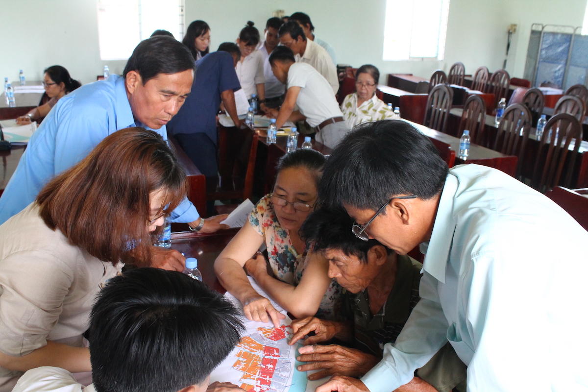
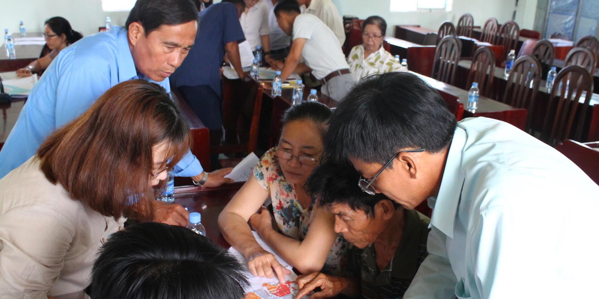
Local officers from across levels (province, district and commune) and farmers of Tien Giang sit down to co-develop agro-climatic information for the Winter-Spring rice season 2020 Credit: N.Nguyen
“The CS-MAP is a participatory process that produces actual maps, indicating areas at risks of extreme events like drought and will help localities adjusting specific seasonal calendars,” said Mr. Le Thanh Tung, Deputy Director of MARD-DCP, one of the main partners. “At the same time, water supply agencies and specialized units can coordinate to address localized concerns that will help reduce the risk of water shortage and stabilize production.” CS-MAP was developed for implementation at the provincial scale, but with support of DeRISK the results are translated to the commune level in consultation with local officers for more specific and tailored climate-informed agro-advisory.
DeRISK has helped CCAFS scale up the work on CS-MAP to South Central Coast and Red River Delta region. In January 2021, DeRISK participated in a handover ceremony, organized by MARD-DCP and CCAFS SEA, of CS risk maps and adaptation plans to 12 provinces in the Red River Delta and Northern Midlands of Vietnam. In establishing the need for risk maps and adaptation plans, Kees Swaans, Principal Investigator of DeRISK said, “With more than 1 million hectares of agricultural land dedicated to growing rice, vegetables, and other short-term industrial crops, the Red River Delta is the main agricultural production area in Northern Vietnam. However, it is highly dependent on water supply from large reservoirs in the upstream to address water shortages.”
Building on these efforts, DeRISK intends to contribute to and improving climate-related policies and institutional environment in Vietnam by linking progress made to national policies and strategies, including the UNFCCC National Adaptation Plans and the National Framework for Climate Service. This will ensure that strong coordination mechanisms are established among partners at all levels and between different sectors; enabling climate service actors to contribute to delivering climate information and agro-advisories up to the last mile.