Blog From data to action: Empowering Zambia’s meteorologists with the latest skills and tools

In November 2024, the Zambia Meteorological Department (ZMD), with support from AICCRA, held a capacity-building session in Lusaka to address challenges in GIS skills and advisory dissemination. This aimed to strengthen decision-making in agriculture amidst climate risks.
By: Grace Koech, Majambo Gamoyo, Joseline Kiogora, Stephen Sande, Joseph Chemutt, Degefie Tibebe, Emely Mwale and Ghosh Aniruddha
In a rapidly changing climate, the ability to accurately interpret and disseminate weather and climate data is critical for decision-making. This is particularly true in Zambia, where agriculture remains a cornerstone of livelihoods and economic stability, yet is highly vulnerable to climate variability and extreme weather events. Recognizing this challenge, the Zambia Meteorological Department (ZMD) has taken significant steps toward addressing gaps in climate data management and dissemination, with support from the Alliance’s recent capacity-building initiatives.
The Challenges: Bridging Gaps in Agromet Services
The Zambia Meteorological Department (ZMD) plays a vital role in delivering weather and climate information that is essential for decision-making in agriculture and other climate-sensitive sectors. However, the department has faced significant challenges that have hampered the effectiveness of its services. One of the primary obstacles has been limited expertise in Geographic Information Systems (GIS). While ZMD collects valuable weather data, insufficient proficiency in GIS has made it difficult for meteorologists to analyze spatial patterns of weather parameters efficiently. This limitation has delayed the generation of timely weather maps, which are crucial for informing stakeholders promptly.
During a meeting with ZMD held on July 2024, Ms Micah Namukoko highlighted that “the generation of maps for bulletins takes time due to the limited number of experts in GIS.”
Another significant challenge lies in the inefficient dissemination of advisories. The process required extensive manual effort, leaving staff overwhelmed as they managed multiple communication channels simultaneously to reach various stakeholder groups. This lack of automation not only strained resources but also increased the risk of delays, reducing the impact of critical climate information when it was needed most.
The Solutions: Empowering Meteorologists with Skills and Tools
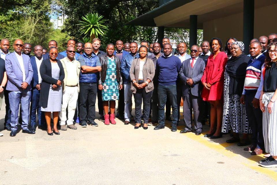
To address these challenges, the Accelerating Impacts of CGIAR Climate Research for Africa (AICCRA) conducted a capacity-building training for the Zambia Meteorological officers in Lusaka, Zambia, on 21-22 November, focusing on two key areas: GIS skill development and the introduction of an integrated dissemination portal.
1. GIS Skill Development
The GIS training session was designed to equip participants with the skills to analyze and visualize weather and climate data in a way that informs decision-making. Conducted in an interactive and hands-on format, the session allowed participants to engage with both the theoretical and practical aspects, ensuring they could immediately apply their learning to real-world scenarios.
The training was structured into two key phases to gradually build participant proficiency:
-
Foundational Understanding: The session began with an introduction to GIS principles and tools. Facilitators walked participants through the basics, such as spatial data types, mapping layers, and coordinate systems. This foundation ensured that participants, regardless of prior experience, had the necessary knowledge to engage with the software and datasets effectively.
-
Hands-On Application: Using real-world climate data, participants learned to input, manipulate, and analyze information. Exercises focused on mapping key weather parameters such as rainfall distribution. Facilitators demonstrated how these visualizations could highlight spatial variability and identify climate trends, such as drought-prone areas or regions vulnerable to flooding.
By the end of the session, participants had developed practical GIS skills that bridged the gap between raw climate data and actionable insights. They gained the ability to:
- Visualize spatial patterns of weather parameters to identify climate risks.
- Generate detailed, user-friendly maps that effectively communicate complex data to stakeholders.
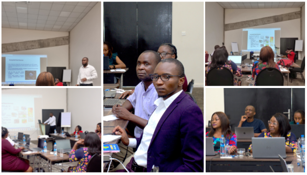
Highlights from the Training Sessions: Participants engaging in collaborative discussions and practical applications.
2. Integrated Dissemination Portal
The introduction of the new dissemination portal marked a turning point in how the Zambia Meteorological Department (ZMD) communicates critical weather and climate information. Designed to streamline the distribution of advisories, the portal integrates multiple communication channels including WhatsApp, social media, email, and SMS into a single, automated platform. During the training, participants were guided through the portal's features and functionalities, learning how to use it to enhance the speed, accuracy, and reach of their climate advisories.
The session on the dissemination portal was structured to ensure that participants gained both technical know-how and practical experience:
-
System Overview and Orientation: Facilitators began by introducing the portal’s purpose and key features, emphasizing how it addresses ZMD’s existing challenges in communication. Participants explored the portal’s interface, gaining an understanding of its capabilities, including automated scheduling, real-time updates, and multi-channel integration.
-
Hands-On Practice: Participants were given access to the portal and worked through different examples. For example, creating a weather bulletin for different regions. This practical exercise allowed them to experiment with various communication formats and test the system’s efficiency in distributing information.
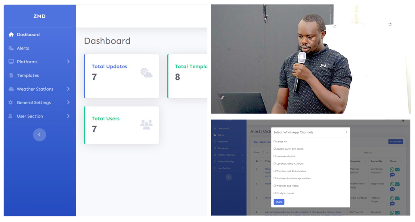
- Interface of the Dissemination Tool: Participants explored the functionality of the dissemination channel tool during the training session, learning how to automate the creation and distribution of weather bulletins. The tool’s user-friendly interface enables seamless integration of forecast data and supports multi-channel dissemination, including SMS, email, and web platforms, ensuring timely delivery of critical weather information to diverse end users.
The portal will revolutionize how ZMD disseminates weather advisories by addressing critical inefficiencies in their communication processes. With its automation features, the portal eliminates the need for manual management of multiple channels. Its centralized management ensures consistent and uniform messaging across all channels, reducing errors and saving valuable time. Moreover, the portal’s enhanced reach enables tailored advisories to be sent to diverse audiences, from rural farmers needing concise SMS alerts to policymakers requiring detailed updates via email.
"Previously, I had to manually moderate six different WhatsApp groups, which took hours of my day. This tool automates the process, ensuring that accurate information reaches the right audience without delays. It’s going to revolutionize how we operate." Peggy Thole - Meteorologist, Zambia Meteorological Department.

Following the successful implementation of GIS skills and the dissemination portal, several key steps have been outlined to maximize the impact of these tools:
-
Technical Support
To sustain the momentum from the training, CIAT will provide ongoing technical support, and advanced training opportunities for participants to further refine their GIS skills and apply them effectively in their professional roles.
-
Streamlining Data Processing with an RShiny App
An RShiny application has been developed to streamline the processing of climate data into actionable outputs. This tool will create an automated pipeline for generating maps, charts, and summaries, reducing manual effort and enhancing the efficiency of GIS workflows. The app’s intuitive interface is designed to empower users to process climate datasets and produce high-quality maps for decision-making.
-
Iterative Improvements to the Dissemination Portal
The initial rollout of the dissemination portal has already yielded valuable user feedback from workshop participants. These comments and suggestions will be systematically reviewed and incorporated into future iterations to enhance the tool’s functionality, usability, and integration with existing systems. This iterative approach ensures that the portal remains aligned with user needs and operational requirements, optimizing its role in delivering timely and accessible weather information.
The Team

Aniruddha Ghosh
Senior Scientist
Grace Koech
Senior Research Associate
Degefie Tibebe
Research SpecialistSee Also