Research Articles Under the surface: research identifies 20,700 hectares that can produce crops in Senegal
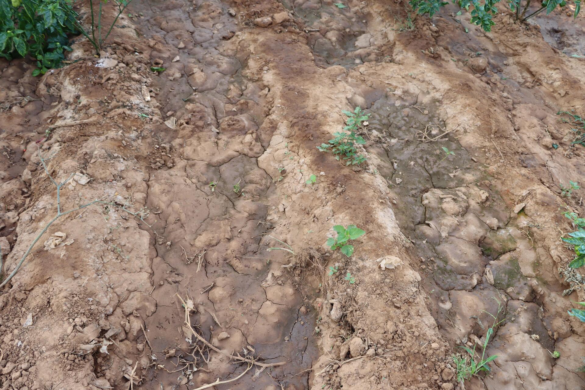
In Senegal, water from the rainy season doesn’t fully disappear—it seeps into the clay-sandy soils of the lowlands in Sédhiou and Tambacounda, creating a hidden reservoir still largely untapped. As part of the AVENIR project, researchers from the Alliance Bioversity International & CIAT—led by Dr. Issa Ouédraogo, with Wilson Nguru, Wuletawu Abera, Christine Chege, Babacar Kane, Katiana Bougouma and Caroline Mwongera—analyzed nine years of Landsat images cross-referenced with soil and crop data. Their work identified 20,700 hectares ideally suited for Flood Residual Water Cultivation (FRWC), a low-cost, resource-smart approach that extends the growing season, boosts rural incomes, and enhances climate resilience.
Hidden moisture that can feed families
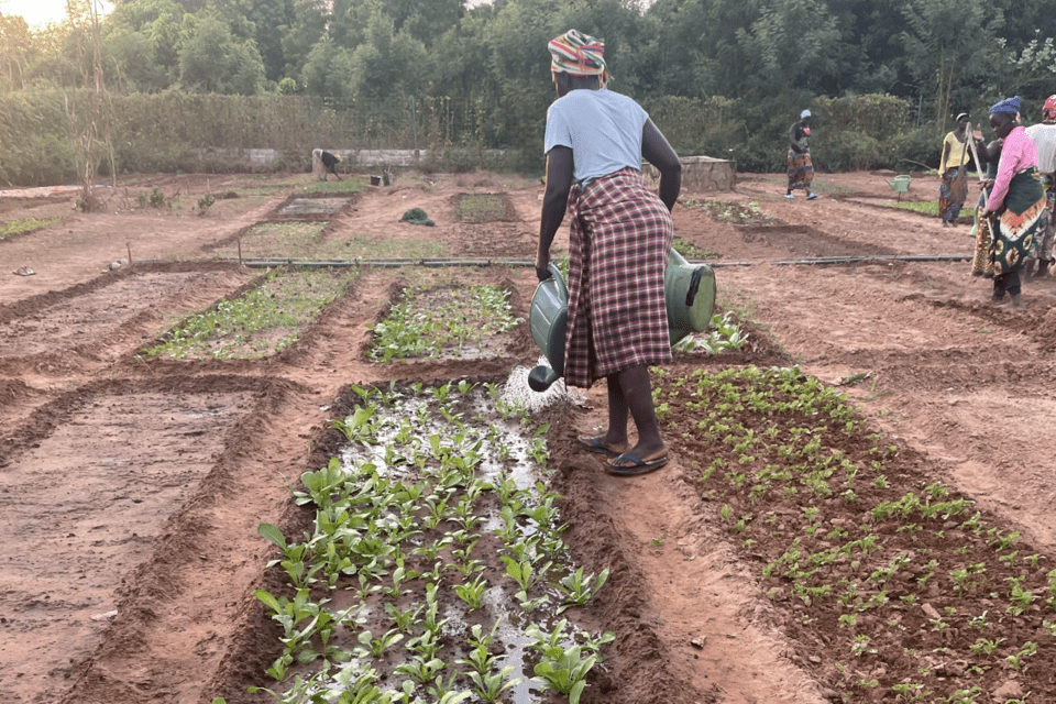
At the end of the rainy season, lowland soils may appear dry on the surface, but deeper down, fine clays retain water for weeks. The AVENIR study reveals that on 20,700 hectares, this natural moisture is enough to support short-cycle crops such as early-maturing rice, millet, cowpea, or sweet potato. Sowing starts in mid-October, with harvests in February—precisely during the lean season, when cereal stocks are low and prices soar. Economic simulations estimate that residual water farming can yield a net return of nearly 320,000 FCFA per hectare of rice, more than double the earnings from groundnut during the rainy season and with no fuel or pumping costs.
Socially, the practice is transformative. Women make up over 60% of the workforce in lowland areas. FRWC reduces water-fetching burdens and provides direct income that many reinvest in food, healthcare, and girls’ education. From a nutritional standpoint, combining iron-rich cowpea with vitamin A-rich orange-flesh sweet potato helps meet over half of children’s daily micronutrient needs. FRWC also serves as climate insurance: even in erratic seasons, the stored soil moisture helps stabilize yields and reduce fertilizer losses.
By tapping into a naturally occurring resource, communities can turn a previously overlooked process into a reliable opportunity. Scaling up this practice could help narrow the national cereal gap and reduce dependence on imports while building long-term financial stability for smallholder farmers and rural households.
Putting satellite data in farmers' hands
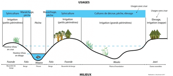
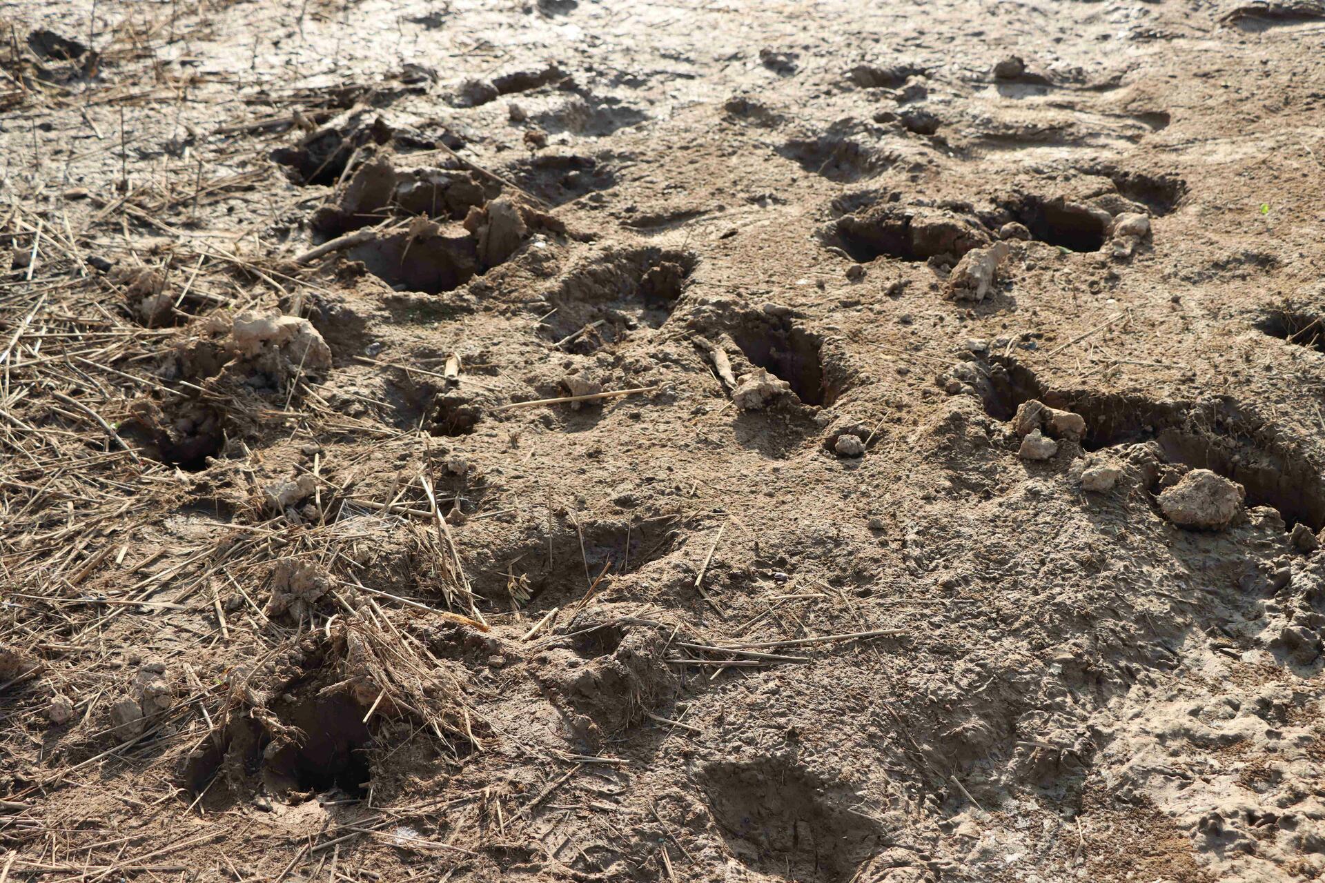
Mapping moisture zones on foot would have taken years. Instead, the AVENIR project relied on Landsat 8 and 9, which pass over Senegal every 16 days. With the NDWI index—capable of separating water from vegetation through clear spectral contrasts—the team compared scenes from peak rainfall in August-September with shots taken at the start of the dry season in November-December. Each pixel received a score from 0 to 9; the highest scores marked spots that flooded repeatedly between 2013 and 2021. Researchers then overlaid those flood-frequency maps with national soil-water-retention layers and with crop-water-requirement tables drawn from the Food and Agriculture Organization’s global guidelines. The combined dataset shows exactly how long the stored moisture in any given pixel can keep a short-cycle crop alive.
Unsuitable terrain—salt-affected flats, protected areas and steep slopes—was removed to keep recommendations realistic. Local farmers helped ground-truth the forecasts by installing tensiometers, and field readings confirmed that predicted moisture windows were accurate to within five days. The end product is a pocket-size atlas, viewable on even the most basic mobile phone, that flags moist pockets and suggests the best crops to sow there.
Two Senegalese universities already teach the open-source workflow in their agro-geomatics programmes, while a Dakar start-up sends out “Décrue-Info” text alerts just before planting dates open. For farmer organisations and extension agents, the tool slices through uncertainty, strengthens loan applications and lets villages organise a true second growing season.
By translating satellite imagery into everyday advice, AVENIR places advanced technology in the hands of smallholders. A sensor orbiting 700 kilometres overhead now guides the humble hoe, proving how cutting-edge science can produce immediate, relatable benefits in local languages and contexts.
A bonus season that changes everything
Using just half of the mapped land—around 10,000 hectares—could yield an additional 10,000 tons of rice and inject over 6.6 billion FCFA into local economies each year. This production arrives when it is most needed—during the lean season, when food is scarce and prices are high—nearly doubling household margins without requiring heavy investment. Farming closer to home also reduces fuel costs and equipment wear and tear.
Flood residual farming plots serve an ecological function too: they act as natural sponges, reducing erosion, replenishing groundwater, and buffering the effects of seasonal droughts. Additional income allows households to afford better nutrition, join health insurance schemes, and send children—especially girls—to school. Farmers’ cooperatives estimate that even modest uptake could generate 3,000 seasonal jobs, helping curb youth migration to urban centers.
Nutritionally, a combination of early-maturing rice, biofortified cowpea, and leafy vegetables delivers protein, energy, and essential micronutrients. New rice varieties with salt tolerance up to 5.5 dS/m make FRWC possible even in saline-prone basins.
By eliminating the need for motor pumps, this approach significantly reduces greenhouse gas emissions: each hectare of FRWC saves up to 0.4 tons of CO₂ equivalent per season.
Altogether, residual water farming forms a virtuous circle—more food, more income, lower environmental impact, and stronger climate resilience. It proves that a simple shift in land use, guided by the right data and support systems, can lead to transformational change for thousands of Senegalese families.
From diagnosis to collective action
Turning maps into crops requires a coordinated strategy among the state, local governments, farmer organizations, and the private sector. The first step is to officially integrate Flood Residual Water Cultivation into agricultural and climate policies, ensuring access to funding and technical support. At the same time, around 200 farmer field schools could train 10,000 farmers—mostly women—in early sowing, mulching, and moisture management.
Participatory research should support each season: local seed systems, trials on early or salt-tolerant varieties, good compost use, and crop-livestock integration improve productivity while reducing risks. In the field, small, low-cost infrastructure—bunds, live hedges, trenches, and water granaries—extends moisture availability and protects soils. A digital platform links producers to buyers, displays real-time volumes, and coordinates logistics, cutting post-harvest losses by about 20%.
To secure incomes, weather-based index insurance quickly compensates households when seasons end prematurely or floods destroy seedlings. Low-cost moisture sensors help refine practices, while community radios broadcast simple agronomic advice in national languages. Lastly, lower fuel use opens the door to carbon credit mechanisms, further boosting the financial sustainability of the approach. If expanded to the floodplain basins of the Senegal River, this approach could unlock 50,000 hectares and create around 7,500 green jobs. With strong coordination, inclusive policies, and smart technologies, residual water farming has the potential to become a cornerstone of food security and shared prosperity in Senegal.