Crop Type Mapping for Rwanda
The Crop Type Mapping for Rwanda project aims to use a multi-scalar remote sensing approach, combining various data sets and technologies and aims to develop and pilot an automated remote sensing-based crop mapping system that can be integrated with Rwanda’s Agricultural Management Information System (AMIS) and the Smart Agriculture System (SAS).
Project Name (full): Crop Type Mapping for Rwanda
Start and end date: 15th November 2024 to 1st September 2025
Geographic area, countries: Rwanda: The pilot implementation focusing on four districts: Nyagatare, Musanze, Nyabihu, and Ruhango, with specific emphasis on the consolidated cropland areas (food basket sites) for which land parcels are mapped and required information for crop mapping is available.
Funders: GIZ
Partners: The project is being implemented in collaboration with The Ministry of Agriculture and Animal Resources (MinAgri) and the Rwanda Space Agency (RSA).
Project Description
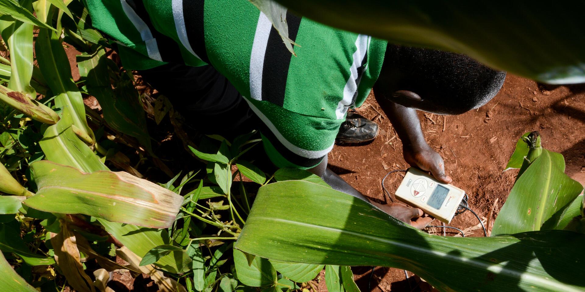
Rwanda’s agriculture sector is highly vulnerable to climate variability, making timely and accurate crop monitoring essential for food security and resilience planning. This project seeks to revolutionize agricultural monitoring by developing an automated remote sensing-based crop monitoring system that integrates with the Agricultural Management Information System (AMIS) and the Smart Agriculture System (SAS). By leveraging data from Sentinel-1, Sentinel-2, Sentinel-3, Planet, and Worldview satellites, the system will provide multi-scalar crop monitoring capabilities, including early warning, trend analysis, and high-resolution mapping. A pilot study in selected districts will evaluate the system’s accuracy, cost efficiency, and operational feasibility. What sets this project apart is its focus on automation and national-scale integration. Beyond monitoring, it will create a roadmap for scaling up, ensuring seamless data management, interoperability, and integration with Rwanda’s Regional Hydrological Extremes Assessment System (RHEAS) for potential yield estimation. By supporting evidence-based decision-making, this initiative will enhance Rwanda’s ability to predict agricultural trends, improve food security, and strengthen climate resilience. The project is a significant step toward smart, data-driven agriculture, empowering policymakers and farmers with real-time, actionable insights.

Key Activities
- Inception Workshop: Aligning expectation and establishing Collaboration framework
- Data Sourcing and Pre-Processing: Handling terrain and atmospheric challenges in Remote sensing data
- Data collection
- Rapid prototyping of crop Type Mapping: Developing and testing crop classification approaches
- Capacity building and technical support: Ensuring local ownership and long-term sustainability
- Roadmap Development for Long-term Integration
Other project members: Joseph Chemutt – Geospatial information Scientist and Software Developer, and Stephen Sande – Geospatial Specialist
Relevant blogs, stories, news coverage
Project leaders

Aniruddha Ghosh
Senior Scientist
Anastasia Wahome
Research Team LeaderProject members