
Geospatial Methodology for Identifying and Prioritizing Nature-Based Solutions

Developing a globally applicable geospatial methodology to identify and prioritize nature-based solutions in rural landscapes, with a focus on least developed countries.
Project Name (full): Geospatial Methodology for Identifying and Prioritizing Nature-Based Solutions
Start and end date : 2026 - Ongoing
Geographic area, countries: Global focus, with emphasis on Least Developed Countries (LDCs)
Funder: World Bank
Brief description
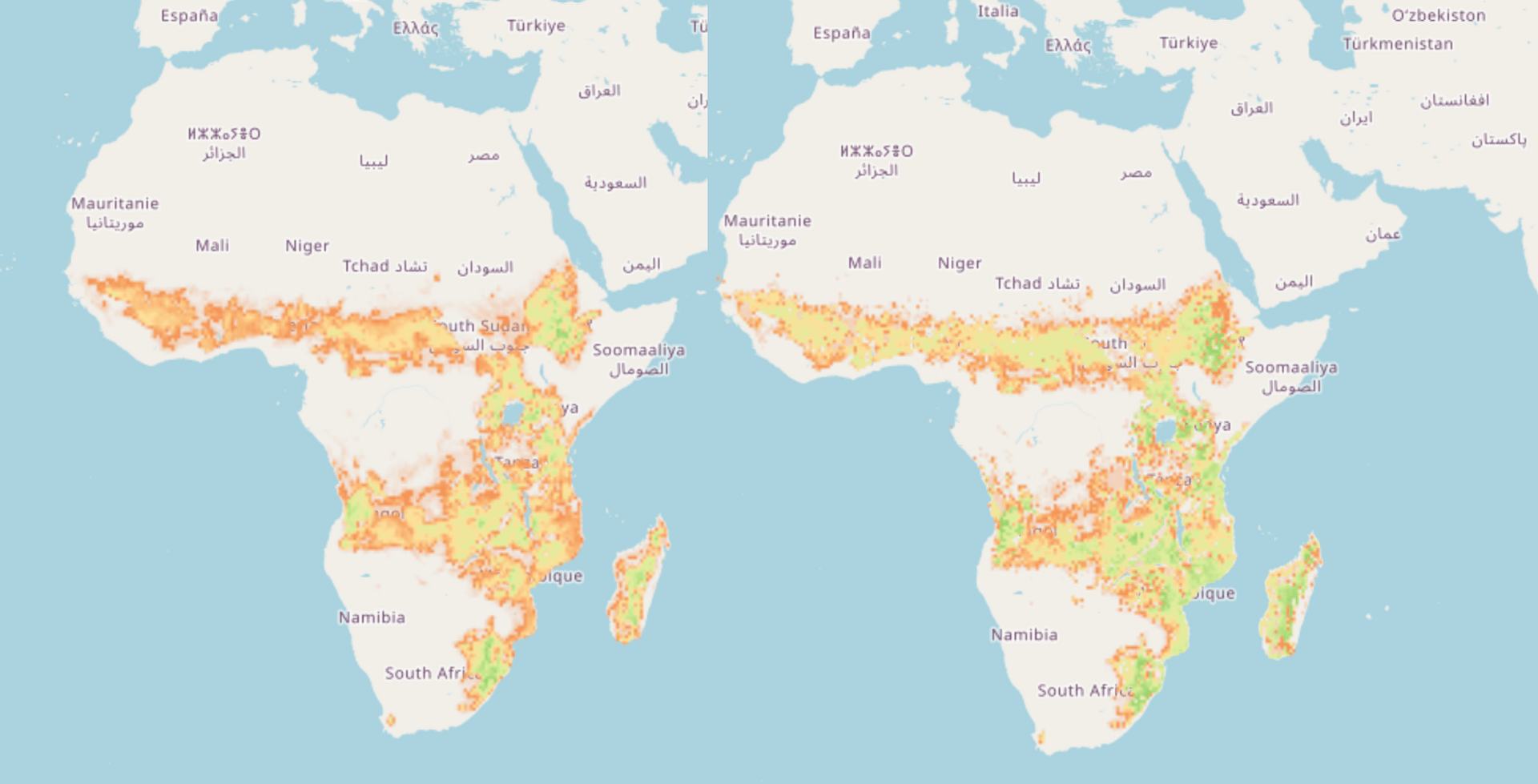
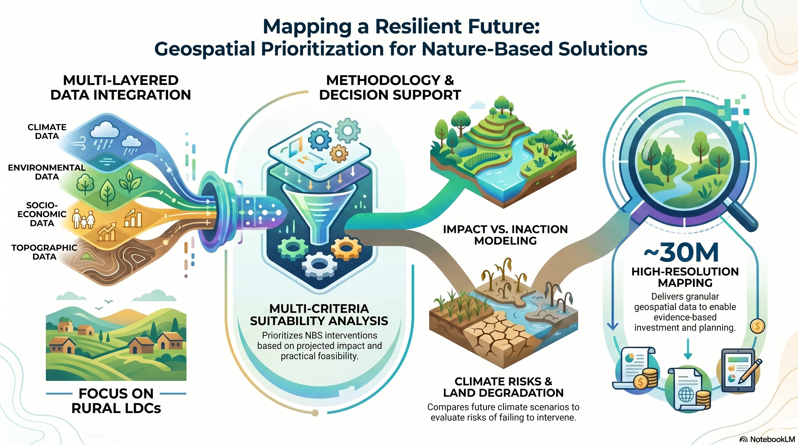
Nature-Based Solutions (NBS) are increasingly recognized as scalable approaches to address climate, environmental, and socio-economic challenges in rural landscapes. This project develops a science-backed, geospatial methodology to identify, map, and prioritize suitable areas for NBS interventions. It focuses on addressing land degradation, climate risks, and unsustainable land use, particularly in Least Developed Countries. The methodology integrates climate, environmental, socio-economic, and topographic data to produce high-resolution suitability maps. It also evaluates the potential impacts of inaction and future climate scenarios. By enabling evidence-based decision-making, the project supports governments and development partners in planning investments that enhance resilience, biodiversity, and livelihoods while optimizing ecosystem services.
Key activities
- Identify and map climate risks, environmental degradation, and socio-economic pressures
- Develop multi-criteria geospatial suitability analysis for NBS
- Prioritize NBS interventions based on impact and feasibility
- Model future climate scenarios and impacts of inaction
- Produce high-resolution maps (~30m) for decision-making
- Support capacity building and knowledge sharing
Project leaders

Peter Steward
Climate Adaptation Data Synthesis and Spatial Analysis ScientistProject members

Hannes Gaisberger
Scientist I
Aniruddha Ghosh
Senior Scientist
Sarah K. Jones
Scientist
Namita Joshi
Research Specialist
Benson Kenduiywo
Research Specialist
Chris J Kettle
Principal Scientist, Lead Tree Biodiversity for Resilient Landscapes
Lolita Muller
Senior Research Associate, Climate Evidence
Evert Thomas
Senior Scientist
Anastasia Wahome
Research Team Leader