From the Field The Big Picture: Can drones improve farmer livelihoods in Sri Lanka?
The short answer: Yes! Discover how drones can help overcome agricultural challenges in Sri Lanka's cascade landscapes and build a mutually beneficial partnership between young researchers and smallholder farmers in the region of Anuradhapura.
By: Dr. Surantha Salgadoe, Sujith Ratnayake and Sharon Mendonce
There’s a reason why aerial shots are so captivating: they reveal a perspective we aren’t used to, and that we most likely can’t experience ourselves. They can also evoke a feeling of awe, when we see the size of humans in comparison to majestic landscapes!
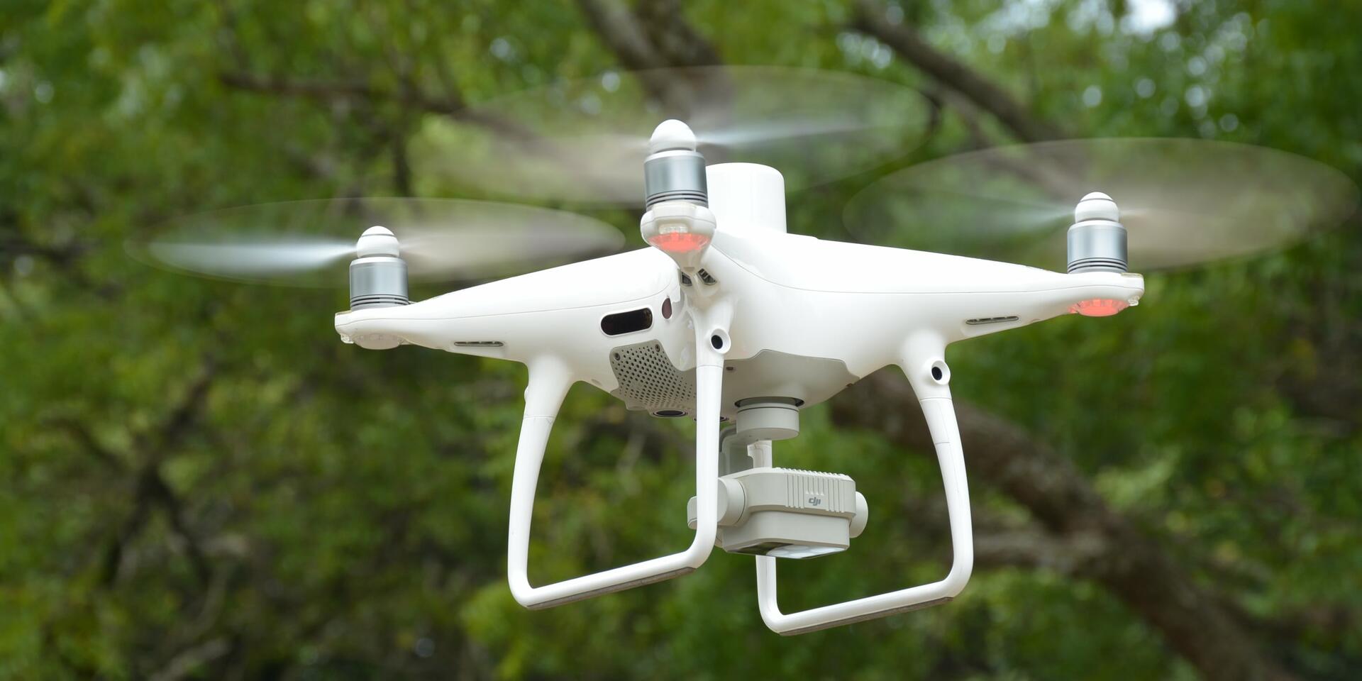
Like several other aerial videos, the one above was captured using a drone (also known as an Unmanned Aerial Vehicle or UAV). Drones are incredibly versatile and can capture footage from various angles and altitudes. Their technology has advanced greatly in the past two decades, enabling them to support crop management and early warning systems, as well as wildlife and forestry conservation.
Mounting pressure in the cascade landscape
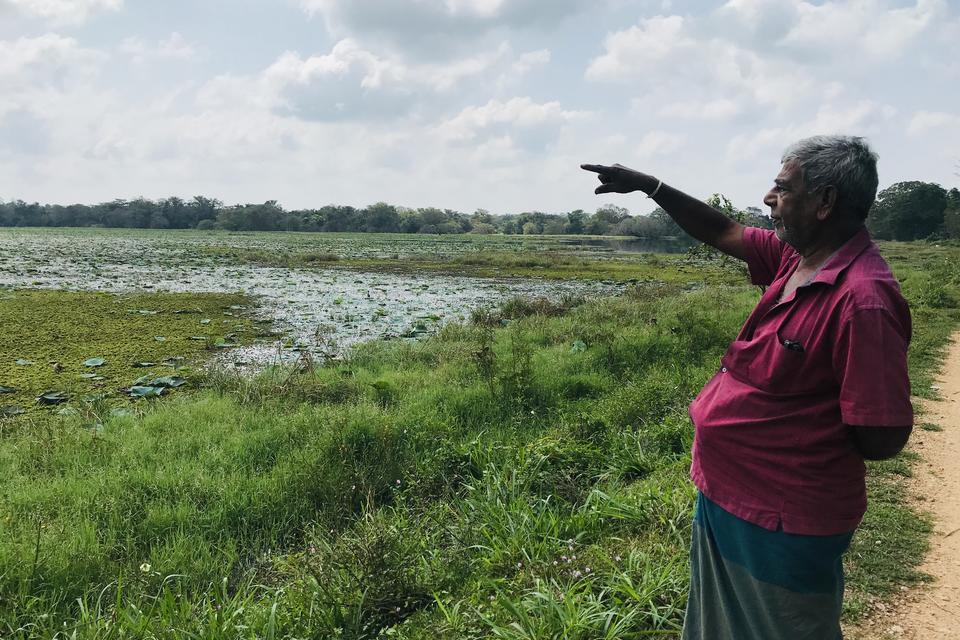
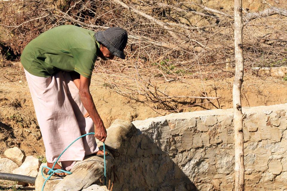
Sri Lanka's unique cascade landscapes consist of ancient networks of interconnected water tanks, as well as the surrounding villages, forests and farmland that depend on these water sources. For generations, a large part of the communities living in these cascade landscapes have depended on farming for their livelihood. As a result, the community has a rich history of traditional knowledge and agricultural practices that have enhanced crop productivity and guided agricultural development in the landscape.
However, today’s cascade landscape farmers face mounting pressures such as the rising cost of living and increasingly unpredictable and extreme weather patterns due to climate change. In the hopes of expanding and intensifying their crop production, many of them have shifted away from traditional agriculture towards mainstream practices. Unfortunately, over the past few decades, the overuse of chemical fertilizers and pesticides has greatly degraded the landscape’s soil and polluted tank water.
Traditional knowledge, much like modern technology, is an evolving knowledge base with information and observations continuously being added. However, in recent decades the world has changed so rapidly and unpredictably that the evolution of indigenous traditional knowledge systems cannot keep up. Additionally, traditional agricultural knowledge and practices, law and gender roles often limit women farmers. For example, women are more likely to be involved in manual activities lower down in the value chains (e.g. weeding and picking), giving them less control over the later stages of production that generate higher income. Cascade landscape communities can no longer solely depend on traditional knowledge and decision-making methods to sustain their livelihoods.
These challenges faced by modern cascade landscape farmers can be addressed by using smart farming techniques - i.e., the use of technologies such as drones, location systems, robots and artificial intelligence for efficient, productive and sustainable farms.
Drone workshops
As part of the Healthy Landscapes project, a two-day workshop on ‘Drone-assisted decision-making in agriculture and natural resources’ was held between 12-13 December 2023. Day one- which centered around the significance and operation of drones-was organized by the Department of Environmental Management, Faculty of Social Sciences and Humanities, Rajarata University of Sri Lanka. Day two- an advanced training session on drone software and mapping- was organized by the Department of Horticulture and Landscape Gardening, Faculty of Agriculture and Plantation Management, Wayamba University of Sri Lanka.
The sessions brought together 25 participants from academia (students, lecturers, and researchers) and government institutions such as the Wildlife Department, Forest Department, Department of Agriculture, Provincial Environment Authority, Department of Agricultural Development and Department of Land Use Policy and Planning.
A closer look at drones
Drones capture light reflected from natural resources, crops, or vegetation, and then create extractable high-resolution, geo-referred (spatial) digital images. These images can provide information on area, size, height, biomass, crop condition, crop greenness, moisture level, soil nutrient availability and water availability.
As a result, smart farming techniques that use drones can map and measure available natural resources; measure crop health; detect early signs of plant stress, disease and pest infestation; perform targeted fertilizer applications and even estimate crop yield or loss.
Ultimately, drones can support smart decision-making in agriculture, potentially reducing the cost, uncertainty, and environmental impact of crop production. Specifically, when used to identify the distribution and fragmentation of natural resources, they can be used to better manage natural resources, and support overall community development planning.
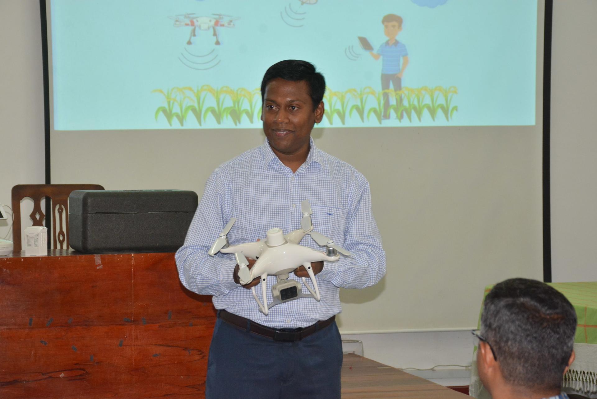
Dr. A.S.A. Salgadoe, Senior Lecturer, Department of Horticulture and Landscape Gardening, Wayamba University of Sri Lanka led the workshop. He covered a vast range of topics including drone applications in agriculture, types of drones and their functioning. Photo credit: Rajarata University of Sri Lanka
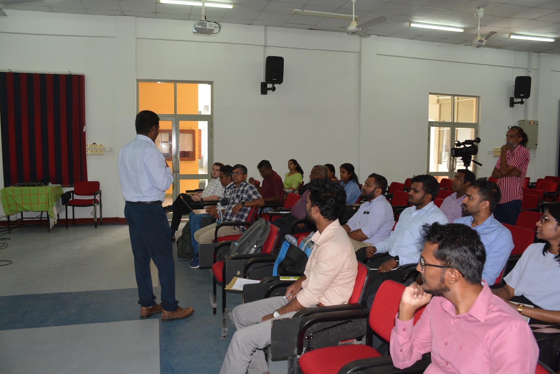
Photo credit: Rajarata University of Sri Lanka
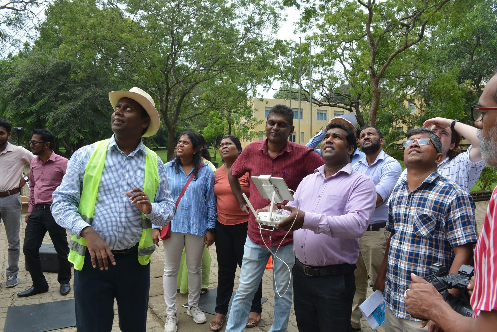
Participants were trained on drone setup and operation, with each one of them having the opportunity to maneuver a drone midair. They were also familiarized with best operation practices in drone flying, flight safety and troubleshooting. Photo credit: Rajarata University of Sri Lanka
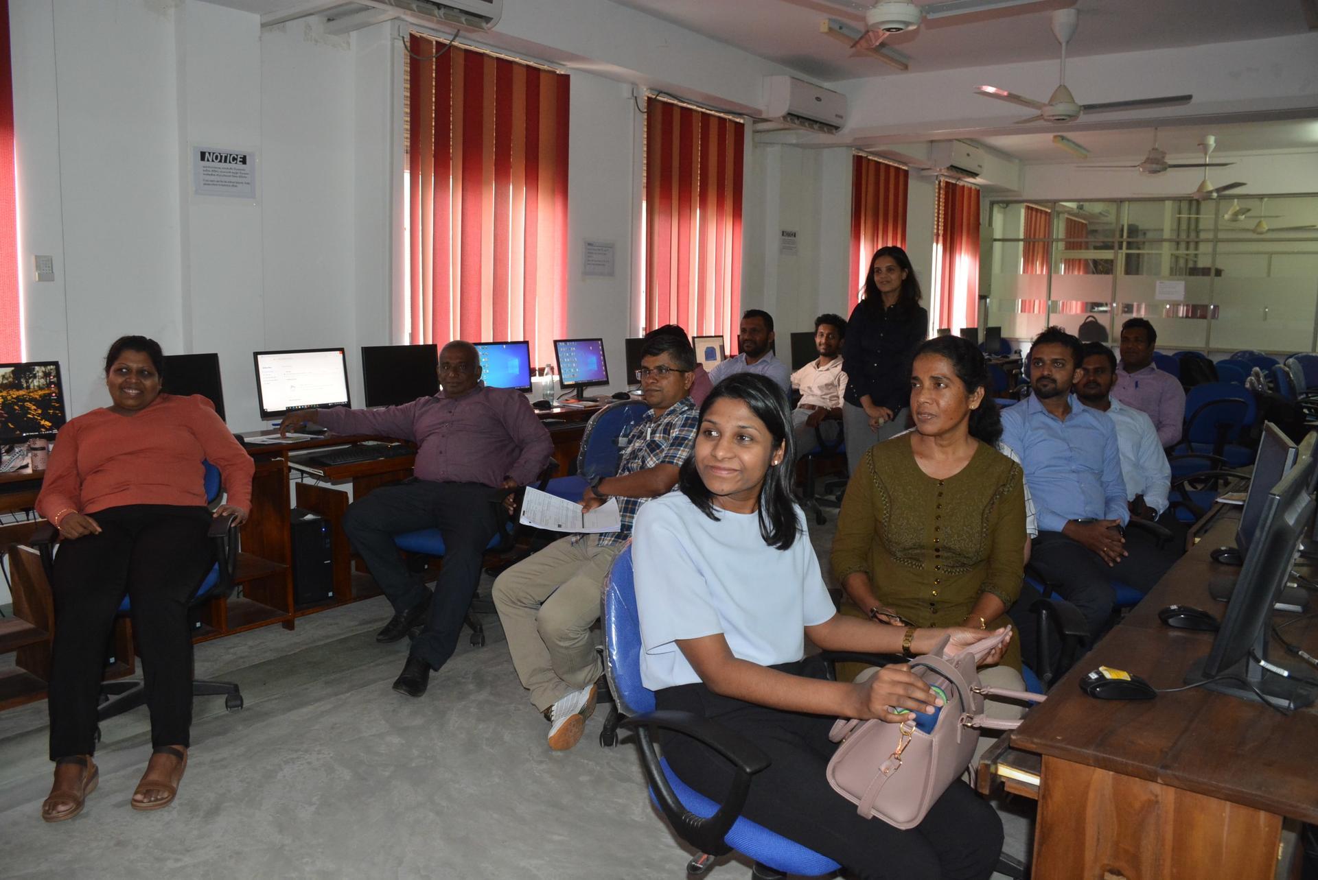
Participants learnt how to process drone imagery using Pix4D mapper software and then developed interactive spatial maps using QGIS software. The session concluded with participants using the drone images to create a crop health map. Photo credit: Rajarata University of Sri Lanka
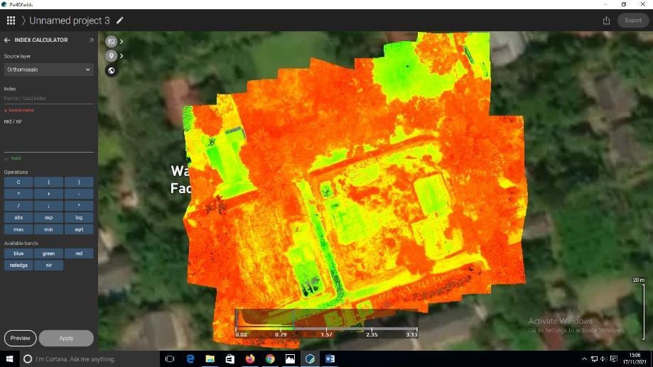
*Crop health maps can help farmers track the vigor and health of their crops without having to inspect every inch of a farmland themselves. These maps can be transferred to smartphone devices or printed for easy traceability on the ground. Photo credit: Rajarata University of Sri Lanka
Ready for takeoff?
Though drone technology requires specialized training and is expensive, the potential benefits gained from its use greatly outweigh this cost. With the precise information they provide on crop health and natural resources, drones can help farmers better manage their farms, improving farm productivity, efficiency, and sustainability. Furthermore, improving access to drone technology can strengthen the agency of women farmers by reducing their dependence on men for labor and providing opportunities for rural youth who are increasingly migrating to urban areas for better livelihoods.
As the training session ended, Dr. Surantha Salgadoe shared his thoughts on the future of drones in the cascade landscape:
“Affording a drone per person may not currently be feasible, but empowering community youth-based drone stewardship could be an excellent investment and employment-generating avenue in the tank cascade landscapes.” He continued, “The younger generation is rapidly embracing digital tools like drones and smartphones, regardless of gender. Providing them with the necessary skills will create a new way of looking at natural resources and crops, greatly increasing the engagement of youth in agriculture.”
Meet Sharon

Sharon Mendonce
Research AssociateThe Healthy Landscapes project aims to build the capacity of and strengthen partnerships between the cascade landscape different custodians, to ensure its use by both current and future generations. Therefore, the project sponsored both sessions in collaboration with two of its key research partners, Rajarata University of Sri Lanka and University of New England, NSW. Australia.
The Global Environment Facility (GEF), the world’s largest public funder of international environmental projects, is supporting the Healthy Landscapes project led by Sri Lanka through the Ministry of Environment as the Lead National Agency. The Alliance of Bioversity International and CIAT is coordinating the project with implementation support from the United Nations Environment Programme (UNEP).