From the Field Open sharing of standardized data for sustainable agricultural
Standardized data on agronomic traits – from soil types to weather patterns – can power big data tools and help accelerate sustainable agricultural growth. But how to establish a culture where data is collected in a standardized format and openly shared?
Standardized data on agronomic traits – from soil types to weather patterns – can power big data tools and help accelerate sustainable agricultural growth. But how to establish a culture where data is collected in a standardized format and openly shared?
Precise, location-specific recommendations on how to improve agricultural yields – by applying the right amount of fertilizer or harvesting at the right time, for example – have catapulted agricultural productivity forward in countries such as Jamaica, Colombia and India.
But such specific recommendations are underpinned by data, and not all countries have a precedence of sharing data. In Ethiopia, for example, existing agronomic data are currently either not preserved, not shared, not standardized or not brought together in a useful way. Instead, decision-makers have been forced to rely on one-size-fits all recommendations, which do not meet the needs of farmers spread across Ethiopia’s highly diverse and heterogeneous landscapes. The lack of data hampers Ethiopian farmers‘ production and the country’s economic growth.
Realizing this, a team of scientists from the Alliance of Bioversity International and CIAT has worked with the Ethiopian Ministry of Agriculture (MoA) and the Ethiopian Institute of Agricultural Research (EIAR) to kick-start an initiative that makes data available for better-informed agricultural development decisions. This work has been supported by the German Development Agency (GIZ) and the CGIAR Research Program on Water, Land and Ecosystems (WLE).
So far, we have successfully spurred Ethiopia’s Ministry of Agriculture to develop a national soil and agronomy data-sharing policy, and we are working to develop location-specific fertilizer recommendations for the entire country, an accomplishment that will support Ethiopia’s agricultural transformation agenda.
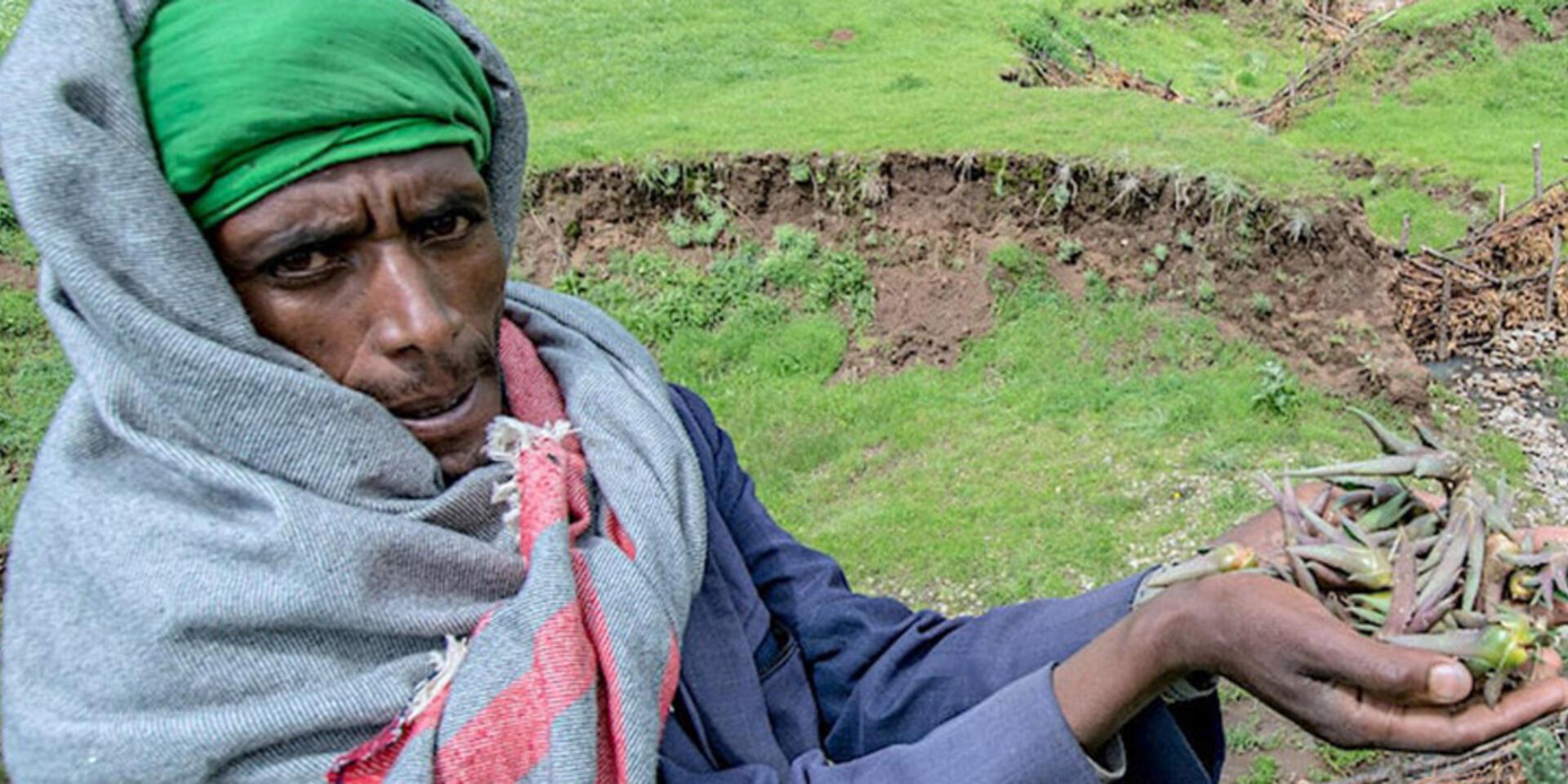
Debre Berhan, central Ethiopia – An entrepreneurial farmer has made a well and employs other water harvesting techniques as part of the “Africa Rising ” initiative. Credit: CIAT/G.Smith
The lessons below summarize the factors we have found to be essential in achieving this progress, and might be of use to other data scientists working toward similar goals.
1: Start with a willing coalition
When we first set out to collate available soil and agronomy data, we quickly realized the value of establishing a ‘coalition of the willing‘ – a group of diverse volunteers willing and interested to engage in data sharing in support of better decision-making. Working with this continuously growing group has enabled us not only to bring together large datasets on for example crop responses to fertilizer applications, but also to champion the idea of open data sharing across different organizations and working groups. This helped establish a sense that data sharing is good practice, rather than something ‘risky’.
2: Establish standards
Standardization is important because it allows decision-makers and scientists to benefit from data collected by all kinds of projects and institutions. In the past, a significant bottleneck to combining and leveraging existing datasets was the fact that data were collected using different formats and approaches that undermined their interoperability.
Based on this experience, our ‘coalition of the willing’ quickly realized that we would be unable to bring existing, but different, datasets together for integrated analysis until data formats had become more streamlined. Therefore, the team recommended finding mechanisms for standardizing soils and agronomy data. The coalition supported a team of technical experts to draft detailed guidelines related to soils and agronomy data collection and analysis. These guidelines will be disseminated to relevant stakeholders, and awareness creation and capacity building will be used to operationalize the tools
3: Collaborate with policy-makers
Developing guidelines and manuals will not bring significant impact unless enabling conditions are set on the ground. It was thus essential to partner and collaborate with relevant offices to not only create awareness, but also get champions at the higher level.
The above efforts and encouraging outcomes spurred the Ministry of Agriculture to establish its own taskforce to develop a data sharing policy. In collaboration with national and international organizations, the taskforce (a large number of which are members of the coalition) drafted a National Soils and Agronomy Data Sharing Policy. The policy has been presented at a national workshop, and is currently awaiting ratification by the Ministry of Agriculture.
Steps are underway to develop guidelines to facilitate implementation of the national data sharing policy, allowing these improved practices to reach scale. When broadly adopted, the policy will help ensure the interoperability of collected data and facilitate integrated analysis.
Hosana, Ethiopia – Entrepreneurial farmer who restored the soils on her plot through installing water harvesting. CIAT/G.Smith
4: Leverage information via big data and ICT tools
The purpose of data sharing in developing countries is to encourage integrated analysis using advanced tools and support knowledge-based decision-making. Combining geospatial data (what works where) with big data tools is particularly useful for developing decision-support tools that can serve extension agents and farmers. In order to make use of the available data (availed by the coalition) and inspire others to join the team, the coalition has been working on various themes including integrating different biophysical co-variates with crop responses to fertilizer application to develop data on location-specific fertilizer recommendations.
The team is also undertaking efforts to combine this fertilizer map with weather and climate information, obtained via remote-sensing technologies, to develop climate-informed agro-advisory services. The detailed ‘content’ will then be disseminated to extension workers and farmers in order to provide them with knowledge on when to plant their crops and what combinations of inputs to use for their specific crops.
The level of details and type of information required varies depending on different stakeholders and actors. For example, farmers are interested in knowing the optimal fertilizer rate for their farm plot, whereas zonal, regional and federal governments are interested in the total fertilizer amount required in a given season or year to be able to decide on purchasing, importing and logistics. These are also among the reasons that we have developed spatial recommendation domains at different spatial scales.
Using standardized data to develop such useful recommendations have demonstrated the value of data access and sharing. The findings, awareness creation and capacity building exercises also encouraged others, and now the coalition of the willing has swelled from 40 to nearly 100 members. The recent development also includes bringing in geospatial experts and data scientists to jointly work with soils scientists and agronomists, which can be promoted into an innovation ‘hub’ in the country. The coalition’s achievement is being noticed in other departments of the country and are also being scaled to other countries, with funders supporting partners in other countries such as in India and Rwanda to follow similar path.
5: Partner with agile dissemination tools to reach farmers
Lastly, it is of course crucial that the knowledge and recommendations obtained via big data tools reach farmers and have an impact on the ground. That’s why partnering with national agricultural research systems and extension groups has been a priority for the coalition from the beginning.
In Ethiopia, the team is collaborating with Digital Green, a global development institution working to build capacity and train extension officers. Through Digital Green, we are planning for our site and context-specific fertilizer recommendations to reach 25,000 farmers through an initial phase, planned for 2021-2022. In addition, the team is collaborating with the Excellence in Agronomy initiative to apply similar approaches to a wheat advisory tool.
With evidence-based, locally bespoke recommendations in hand, Ethiopia’s farmers will be better equipped to overcome the challenges they are facing: producing more and better food, even in the face of a climate emergency, to feed themselves and power the country’s economy. But it all starts with data.
This article was originally published on Thrive Blog, facilitated by the CGIAR Research Program on Water, Land and Ecosystems (WLE). WLE is supported by contributors to the CGIAR Trust Fund.