MAPBIOMAS Water
Applying a novel approach to monitor water in Guyana, French Guyana, and Surinam with satellite images
Start and end date: July 2022, August 2023
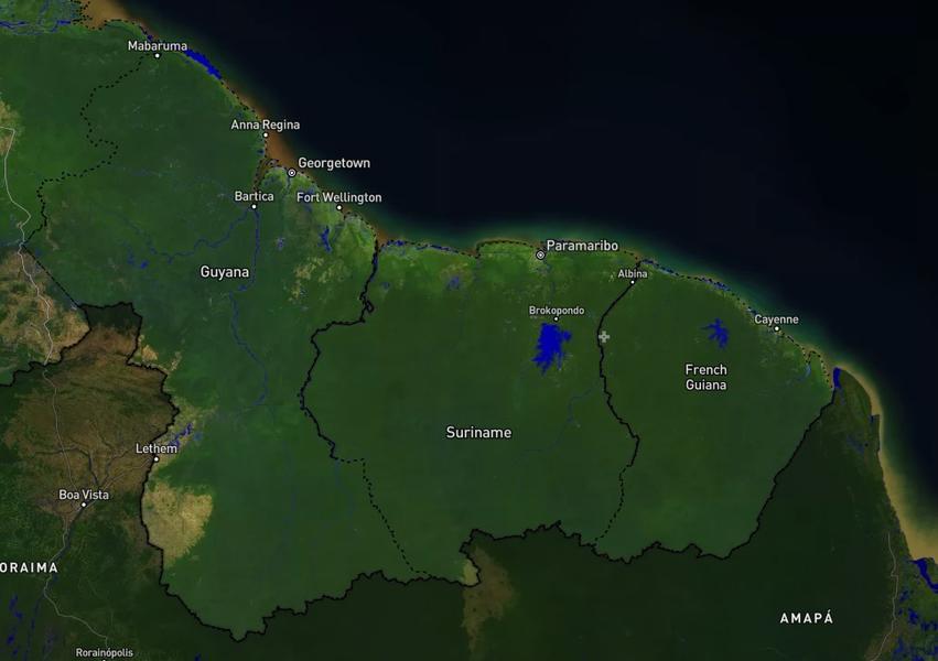
Geographic area: Guyana, French Guyana and Suriname
Funders: Instituto El Bien Comun
The Amazon Basin is one of the world’s largest river systems, responsible for over 15% of the freshwater entering the oceans. The rivers and lakes of the Amazon are essential to agriculture, to the livelihoods of the peoples of the forest, conservation of biodiversity and climate change. However, changes in land use, overuse of water resources and other human activities have altered water quality and availability in the region.
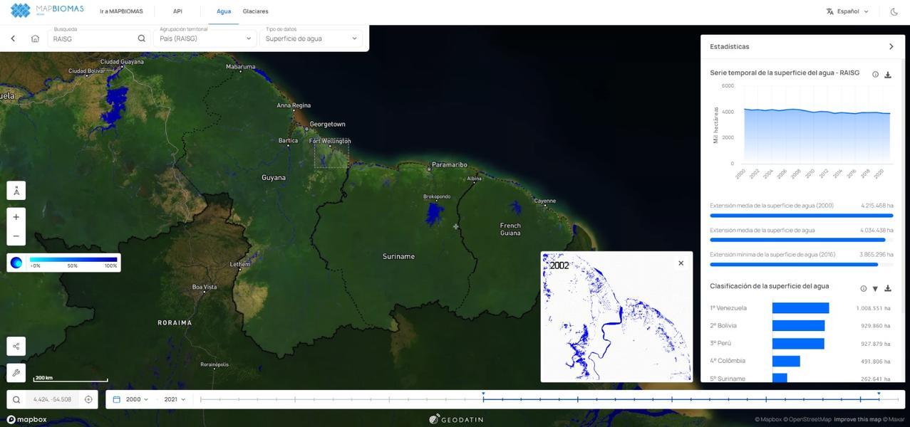
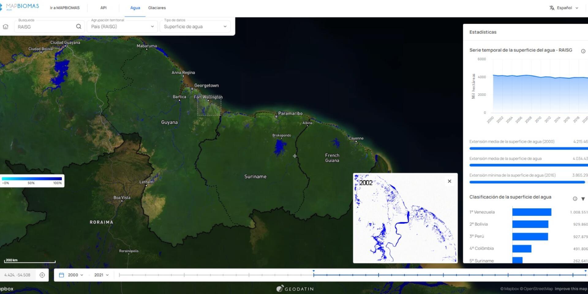
Proper decision making on this scale requires continuously and historically assessing changes in water surface dynamics. To provide this kind of detailed and consistent data and information, a consortium of NGOs created the Mapbiomas Water platform in Brazil. The platform follows an innovative surface water mapping methodology, based on a recent study by Imazon and WWF-Brazil that allows for the identification and quantification of the reduction of freshwater surface in the Amazon biome, especially in wetlands. The monitoring is being expanded to the whole of the Amazon under the Amazonian Network of Georeferenced Socio-Environmental Information (RAISG).
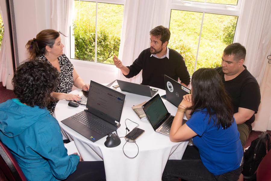
RAISG and the Alliance, in collaboration with MapBiomas and under the advice of IMAZON, will adopt, adapt and apply the methodology built for Brazil for mapping and monitoring surface waters in Guyana, French Guyana and Suriname. The project will initially focus on building the historical dataset from 1985-2022. The work will take place over a period of up to two years, respecting the deadlines established by RAISG. The partnership is being implemented through an agreement between the Alliance and the Instituto del Bien Común (IBC), RAISG’s member responsible for the regional water mapping initiative.
We believe that reliable, high-quality map-based decisions combined with capacity
building at the national level will lead to necessary changes towards sustainable
development. The Alliance will deliver data and information that can support:
● Integrated territorial planning
● Water stewardship initiatives
● Freshwater Ecosystem quality assessments
● Monitor the Sustainable Development Goals 14
● Monitor water concessions/small dams
● Climate Change assessments
KEY OBJECTIVES OF THE PROJECT
● Reconstruct an annual time-series of changes in surface water dynamics in Guyana,
French Guyana and Suriname between 1985 and 2022.
● Characterize the surface water bodies into natural and anthropic classes.
● Provide data and information to RAISG in order to build an interactive dashboard for end-users of the water surface dataset.