Anthropogenic risk assessment of riverine habitat using geospatial modelling tools for conservation and restoration planning: A case study from a tropical river Pranhita, India
Replication Data for: Spatial Variation in Tree Density and Estimated Aboveground Carbon Stocks in Southern Africa
Vulnerability mapping of 100 priority tree species in Central Africa to guide conservation and restoration efforts
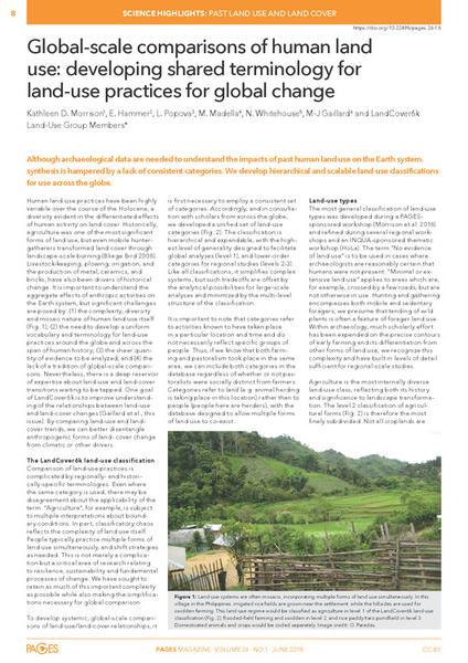
Global-scale comparisons of human land use: developing shared terminology for land-use practices for global change