Winter is coming

Colombia is not governed by the four seasons (summer, fall, winter, and spring). As a result of the two steps of the Intertropical Convergence Zone (ITCZ) over the center of Colombia, the country historically has two rainy seasons (April-May and October-November) and two dry seasons (December-February and June-August). Thus, the so-called “winter” (colloquialism for the rainy season) is characterized by heavy rainfall, causing flooding in different areas of Colombia, sometimes because of the phenomenon of La Niña.
Given the climate prediction models that indicate that winter is coming, is Colombia ready to face another winter 2016–2017 like La Niña 2010–2011?

“When there is a lot of rain, there are crop losses, especially our potatoes and beans, because of fungi. In some places, the seed is recovered but we have lost most.”
María Zoraida Golondrino“Farmers in the planting season hope that the winter will be mild to mitigate the uncertainty of a rainfall deficit.”
Mario Sandoval Contreras“La Niña in Valle del Cauca caused many economic losses for maize crops and delayed the planting of the next cycle because the soils did not drain quickly, thus causing a delay in payments and indebtedness of farmers.”
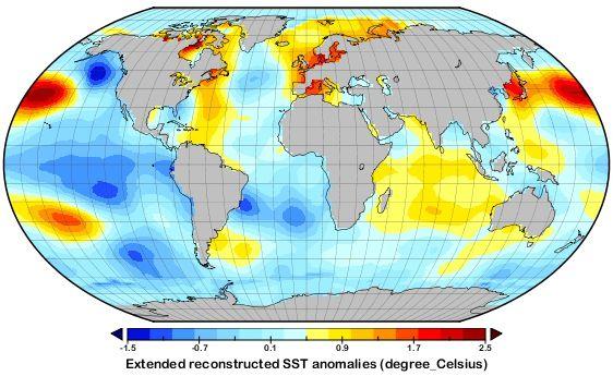
Gustavo LemusIn 2010, there was a rapid transition between the two events, El Niño and La Niña. The formation process began in June 2010 and by September temperatures had reached as low as -1.5 °C with a strengthening of La Niña, which reached its maturity from November 2010 to January 2011 in the strong category, with the event lasting 10 months. The winter cold wave (“Ola Invernal”) came with heavy rains, which caused floods, avalanches, and mass removals of soil in several areas of the country, particularly in the Caribbean and Andean region, which had twice the normal rainfall as in the same period of previous years.
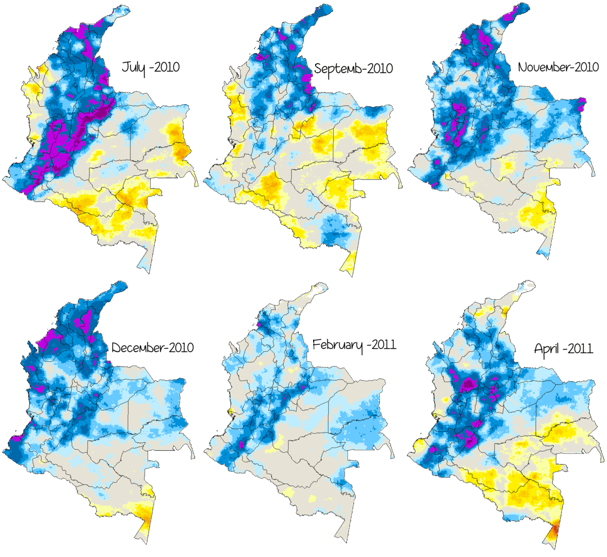
In illustrative maps, the Standardized Precipitation Index (SPI) for analyzing wet and dry periods generated with satellite data and meteorological stations (CHIRPS) shows the areas with rainfall well above historical averages during the last 2010‒2011 La Niña phenomenon, particularly in July, November, and December 2010 and March 2011.
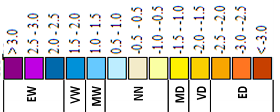
The legend for the map below represents extremely wet (EW), very wet (VW), moderately wet (MW), near normal (NN), moderately dry (MD), very dry (VD), and extremely dry (ED) areas.


It is important to note that, when an El Niño event ends, we should not necessarily expect a La Niña to develop immediately, although this transition takes place in most cases. For example, El Niño events of 1991 and 2002 showed a rapid drop in temperature of the ocean surface, but La Niña did not develop. Also, warm episodes sometimes resulted in cold episodes in the following season, as happened in 1987, 1997, and 2006; however, in each of these episodes, cold conditions had fully developed by the end of July to August. The conditions of a moderate La Niña developed following El Niño 1982‒1983. In this case, the conditions of La Niña took place between September and November 1983.

IDEAM predictions and other international organizations suggest that we are at the gates of another La Niña event whose magnitude is not yet known. In this situation, it is necessary to develop a strategy of prevention and response in the agricultural sector.
Therefore, the goal of the project “Tailored agro-climate services and food security information for better decision-making in Latin America – Agroclimas” is to support private and public sector actors in the implementation and use of tools for agro-climatic risk management – validated and tailored to farmers’ needs – identify gaps and opportunities related to the dissemination and use of agro-climatic forecasts, and develop research recommendations to provide useful, relevant, reliable, sustainable, and applicable solutions for better decision-making.
For further information, please contact project leader Diana Giraldo (CGIAR) [email protected].
