
Research Articles A threat-mapping approach to guide conservation of food tree species in Burkina Faso
In a recent article on PLOS ONE, Bioversity International researchers and partners have analyzed 16 food tree species in Burkina Faso and 6 key threats to them. The analysis will help to plan for timely and efficient conservation actions.
In a recent article on PLOS ONE, Bioversity International researchers and partners have analyzed 16 food tree species in Burkina Faso and 6 key threats to them. The analysis will help to plan for timely and efficient conservation actions.
Agroforestry parklands are among the most widespread traditional land-use systems in sub-Saharan Africa, where scattered individual trees occur on cultivated fields. Over the last decades, agroforestry parklands in Burkina Faso have come under increasing demographic and climatic pressures, which are threatening indigenous tree species that contribute to rural households’ income and nutrition.
In a paper we just published in PLOS ONE, we have analyzed 16 important food tree species in Burkina Faso and 6 key threats to them: overexploitation, overgrazing, fire, cotton production, mining and climate change. This analysis is crucial to plan for timely and more selective and efficient conservation actions.
Our species-specific threat model, developed with national and international partners, combines freely accessible datasets, species distribution models (SDMs), climate models and expert survey results. The model is able to predict, at a fine-scale, wheremultiple threats are likely to have a negative impact on the availability of suitable habitat in the present and near future. This approach helps to determine which threat contributes most to high-threat levels in certain areas of the country. This is fundamental to guide specific conservation actions such as ex situ conservation, active regeneration and tree planting.
 We have found that all 16 species face serious threats throughout much of their distribution in Burkina Faso, and that climate change is predicted to be the most prevalent threat in the long term, whereas overexploitation and cotton production are the most important in the short term.
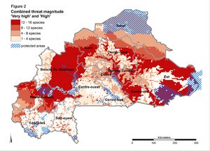
More than 55% of the distribution of ten of the species is under high or very high threat (Figure 2). Conservation plans – prioritizing the species and if possible, the populations, that are most important to local people – should be urgently developed.
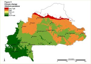
For example, Vitellaria paradoxa, a multipurpose tree with a wide range of food and medicinal uses, is very highly threatened by climate change along its northern margin (Figure 3). Valuable seed sources in this area may be lost unless seed is collected for planting in more suitable climate and/or for ex situ conservation. Populations highly threatened by overexploitation in the central part of Burkina Faso should be prioritized for assisted regeneration as they grow in areas where predicted future climate would produce suitable habitat.
 Knowing the regions where threats are most serious allows decision-makers to plan actions at the population level to maintain the genetic diversity across the species’ distribution range. High genetic diversity is important to ensure growth and resilience to site conditions now and in the future.
In the same way, recommendations can be derived from threat maps of the other selected food tree species such as Parkia biglobosa,Adansonia digitata,Boscia senegalensis and Detarium microcarpum.
This approach can be easily used with other species and in other countries, and applied at different scales, from local to continental level, as long as appropriate spatial data and knowledgeable experts are available.
Using maps to visualize threats and their predicted impact is very powerful – it makes results easily accessible and understandableto decision-makers from private and public agencies, who can take action to conserve vulnerable species.
The GIS threat layers to create the threat maps are accessible on Dataverse
To learn more, read the paper Spatially explicit multi-threat assessment of food tree species in Burkina Faso: A fine-scale approach
__________________
This study was carried out within the framework of the project ‘Threats to priority food tree species in Burkina Faso: Drivers of resource losses and mitigation measures’, financed by the Austrian Development Agency (ADA) and through contributions from the CGIAR Research Program on Forests, Trees and Agroforestry (FTA), which is supported by CGIAR Fund Donors
Images:
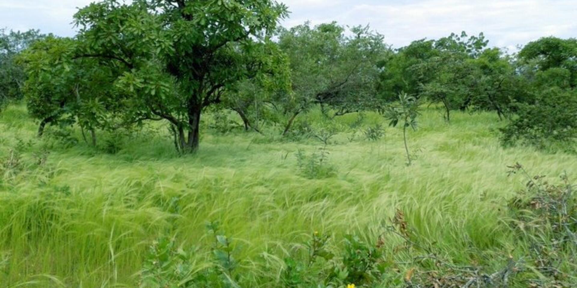
Figure 1: Shea tree (Vitellaria paradoxa) in agroforestry parkland. Credit: Bioversity International/H.Gaisberger
Figure 2: Combined threat magnitude levels ‘high’ and ‘very high’ for all species across all threats and protected areas. Credit: Bioversity International/H.Gaisberger
Figure 3: Threat magnitude levels of ‘Climate change’ for shea tree (Vitellaria paradoxa). Credit: Bioversity International/H.Gaisberger