
TreeEyed: QGIS plugin for tree monitoring
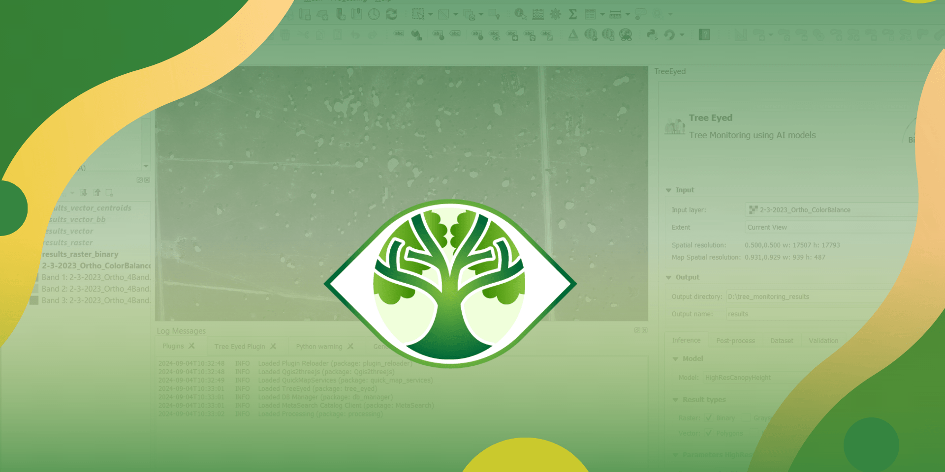
TreeEyed is an open-source QGIS plugin designed to simplify and accelerate tree monitoring in silvopastoral systems through AI-powered analysis of high-resolution RGB remote sensing imagery. Tree monitoring traditionally relies on manual, time-consuming data collection. TreeEyed addresses this challenge by integrating state-of-the-art AI models (such as HighResCanopyHeight, DeepForest, and a custom Mask R-CNN-based architecture) into a user-friendly GIS environment.
This tool enables automatic instance segmentation, or object detection of trees, producing georeferenced vector and raster outputs compatible with standard GIS workflows. TreeEyed supports a range of use cases, from basic tree inference to dataset generation and validation, making it a valuable asset for researchers, developers, and policymakers alike.
In what context is this tool useful?
TreeEyed is especially useful in silvopastoral systems (integrating trees, forages, and livestock) where individual or near-individual tree counting, identification, georeferenced analysis, or monitoring of tree changes over time is needed. It offers a powerful alternative to traditional methods.
Results achieved
The plugin is available in the official QGIS Plugin Repository and downloaded in different countries, with leading numbers from the U.S and Brazil (more than 3000 downloads).
TreeEyed is already delivering meaningful results in real-world scenarios, for example, preliminary tree datasets have been generated for current ongoing projects specifically in Hacienda San José and Tucunaré in Vichada, Colombia. These datasets include trees instances with detailed metrics such as estimated height, crown area, and crown area perimeter. As development continues, TreeEyed is expected to support additional models, larger-scale processing, and derivative analytics, extending its impact and usability across even more countries and contexts.
Variations, scaling and adaptations
TreeEyed is highly adaptable and scalable, designed for use beyond silvopastoral systems. It can be applied in general agroforestry, ecological monitoring, and reforestation projects, wherever high-resolution RGB imagery is available.
Its open-source code is available on GitHub. TreeEyed outputs results in standard GIS and COCO formats, making it compatible with machine learning workflows and geospatial platforms. Researchers can retrain models, generate new datasets, and plug TreeEyed into broader analysis pipelines.
Tools often used together with this tool
QGIS (https://qgis.org): TreeEyed runs as a plugin within QGIS, an open-source GIS platform used for spatial data visualization, analysis, and processing. Users manage input layers, visualize AI outputs, and perform additional GIS operations in QGIS.
Tutorial in the documentation: Using TreeEyed plugin for QGIS to segment trees in raster images
Contact us

Juan Andres Cardoso
Plant ecologist and physiologist
Andrés Ruiz
Research Associate
Research leaders
Juan Andres Cardoso
Plant ecologist and physiologistFunders
TreeEyed was developed by the Tropical Forages Program at the Alliance Colombia - Americas Hub, Palmira Campus as part of research into AI applications for sustainable land management and tree monitoring in silvopastoral systems.
The development was supported by several initiatives and funders, including:
- The CGIAR Initiatives: Livestock and Climate, Sustainable Animal Productivity, and Accelerated Breeding
- The CGIAR Science Programs: Sustainable Animal Food Systems and Multifunctional Landscapes
- The Bezos Earth Fund, through the project Using genetic diversity to capture carbon through deep root systems in tropical soils