
From the Field AGRI: a tool that charts a better way forward for farmers
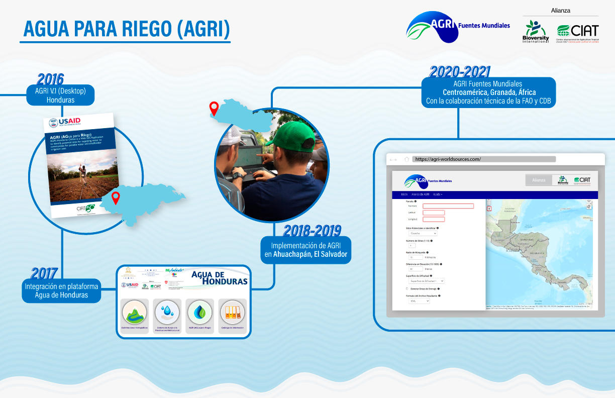
AGua para RIego (AGRI) [Water for Irrigation] is a tool created five years ago by CIAT, now the Alliance of Bioversity International and CIAT, that helps identify potential sites for harnessing water from rivers or for carrying out rainwater harvesting projects to supply irrigation systems for smallholder farmers or local aqueducts.
AGRI was originally developed for western Honduras, an area that is part of the Central American dry corridor. Today, it crosses borders: farmers on the island of Grenada, in the Caribbean, and in Rwanda, Ethiopia and Kenya, in Africa, will also have access to this innovative, free and easy-to-use tool that will improve their productivity, income and resilience. This is what AGRI users say.
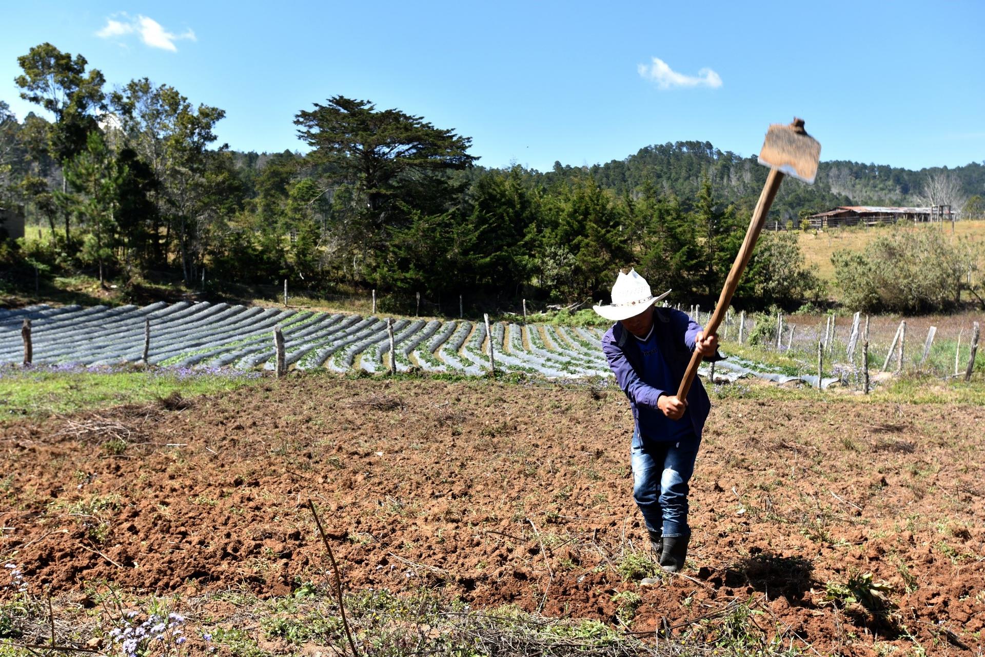
Emiliano's voice is lost in the noise of the three sprinklers that evenly irrigate the furrows of the newly planted crop. A few meters up the hill, Emiliano weeds the furrows of the onions that have yet to grow. In his small plot, he has also planted beans and green beans. This Honduran is taking advantage of his morning shift to water his crop. The fourteen farmers in the rural area of the municipality of Intibucá, in western Honduras, take turns in the three shifts a day and have set up a small-scale irrigation system,
Emiliano Rodriguez says that, thanks to the irrigation system on his plot, production has increased by 15%, allowing him to feed his family and his wife to sell their produce in the nearest town.
Behind this project was Lester de Jesús Arias, designer of irrigation and potable water systems, who participated as supervisor of installation works for Fintrac, in an initiative of the United States Agency for International Development (USAID) to bring water to three thousand hectares under the irrigation system in the Dry Corridor area of Honduras.
Finding the exact site upstream to take the water, mapping the possible routes to transport the resource, having information on the recharge area and water potential was possible thanks to AGRI (AGua para RIego), an automated GIS (Geographic Information System) based tool that integrates publicly available information on terrain, soil and climate with mathematical and hydrological models to identify water sources for small-scale irrigation.
This application was originally developed for Western Honduras: Santa Barbará, Copán, Lempira, Intibucá, Ocotepeque and La Paz, by researchers from the International Center for Tropical Agriculture (CIAT) - today, the Alliance of Bioversity International and CIAT - with the support of USAID/Honduras.
How does AGRI work?
Starting at the plot to be irrigated, AGRI scans the surrounding area to identify potential sites for implementing water catchments from drains or for rainwater harvesting. AGRI also displays viable routes to transport water by gravity from the source to where the water resource will be used and identifies the water catchment area for each site.
These features of the tool captivated Victor Saravia, executive director of the Ecological Association of San Marcos Ocotepeque (AESMO). Since 2019, AGRI became the main partner of this environmental organization when purchasing land for biodiversity, water and soil conservation in the Trifinio area in Honduras and in other areas of the Honduran Dry Corridor.
The tool has been used by AESMO for the conservation of biodiversity, water and soil in the Trifinio area in Honduras and in other areas of the Honduran Dry Corridor.
AGRI is a powerful tool that helps us identify plots with water potential. For the community, it means securing water sources for current and future consumption," says Victor, who proudly repeats that with AGRI's support, 176 hectares of forest have been purchased with resources from the community itself, cooperatives and international organizations in the Volcán Pacayita and Güisayote biological reserves. Recently, another 64 hectares of forest were identified with AGRI and are in the process of being purchased.
Another person convinced of the benefits of AGRI is Angie Eliana Rodríguez, an AESMO forest ranger in the Pacayita volcano protected area. Her duties include patrolling and monitoring areas affected by deforestation, using the Terra-i, platform, also developed by CIAT, to identify areas with good sources of water and biodiversity and initiate the process of purchasing these fertile lands.
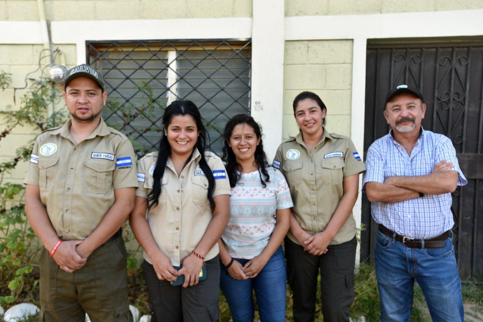
Work team of the Ecological Association of San Marcos Ocotepeque (AESMO). This organization was created in 1990 and in their search for alternatives to solve environmental problems they have used the AGRI tool.
The first clues are given to them by AGRI from their desk. This tool reduces the time needed to identify viable water sources from months to a few days by providing useful information for better decision making. And so, with the exact coordinates, Angie and her team go out to the field to ground-truth the data provided by AGRI on the computer.
Water harvesting, another potential benefit of AGRI
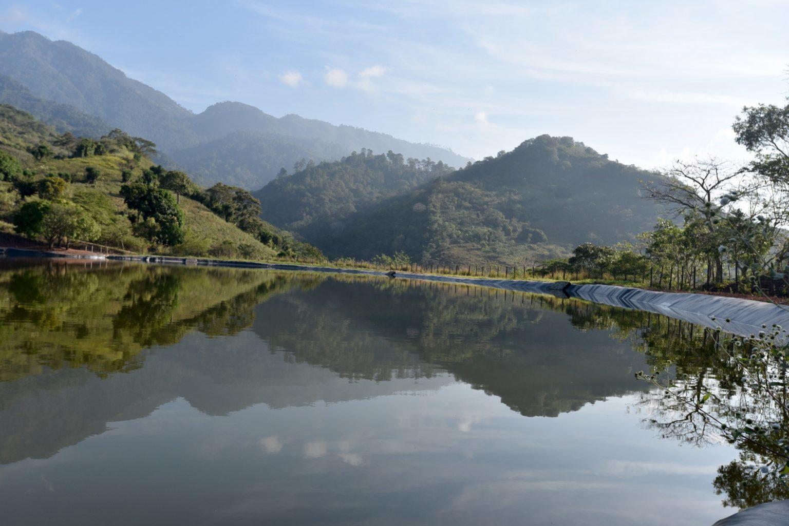
This reservoir is located in the village of La Azomada, in the municipality of Gracias, Lempira. More than 60 farming families benefit from its water to irrigate their crops. Photos: Adriana Varón/Bioversity-CIAT.
The rays of the cold morning sun beat down on an artificial lake that today provides sustenance to about 60 families in the village of La Azomada, in the municipality of Gracias, department of Lempira, also in Honduras. This reservoir is fed by a permanent water stream that comes down from the Puca mountain. The communities also take advantage of the rains to fill the reservoir, which has a storage capacity of 42,000 cubic meters for their own service when the dry season begins.
Ángel Serrano is the technical liaison and quality control provider for the Inversión Estratégica de Honduras (INVEST-H) water harvesting project and has witnessed how the dry seasons, a product of climate change, devastate the crops of the communities in the area.
"The producers could not be certain about the success of their crops. They sowed hoping that the provision of water would come through the rain, but rains have become erratic due to the effects of climate change: it rains in large quantities for short times and then long dry seasons hit and dry up the crops," he says.
AGRI played its part in identifying the primary source of water in the mountains. Now, thanks to this reservoir, producers are assured of the water resource and can plant on a scheduled basis, thus improving their quality of life.
According to the Centro de Estudio para la Democracia [Center of Democracy Studies] (2016), "the area known as the dry corridor of Honduras, comprises 132 municipalities located in 14 departments in the southern, western and central part of the country, and is so called due to low rainfall and a marked dry season that causes water shortages for the inhabitants and their crops. Honduras' dry corridor is also part of the Central American dry corridor. "The dry corridor is a socio-territorial space in which climatic extremes have converged in recent years, leaving in their wake severe consequences for smallholder farmers of basic grains and their families, particularly because of drought."
From Central America to the Caribbean and the leap to Africa
The AGRI platform was developed in 2016 for Honduras under the Feed the Future initiative of the U.S. Government.
Thanks to the acceptance among farmers, water management councils and local authorities, AGRI began to cross borders and reached Ahuachapán, in the neighboring country of El Salvador. It was then integrated into the Agua de Honduras platform, an innovation initiative that offers reliable information on the country's water resource.
And less than a year ago, a more reloaded AGRI (AGRI - Global Sources), based on free software and open source, was made available to all of Central America through the support of the Food and Agriculture Organization of the United Nations (FAO).
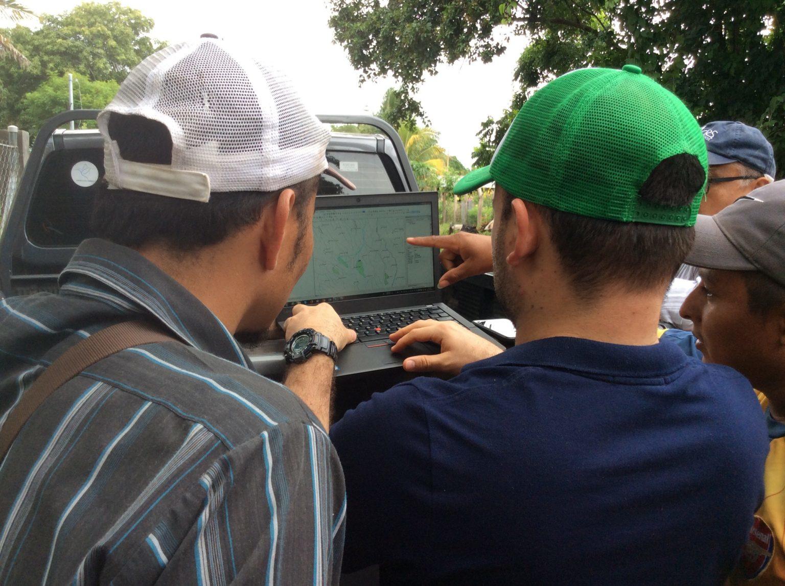
Researchers from the Alliance of Bioversity and CIAT during field training. The tool is freely accessible and easy to use and allows better informed decision making in less time. Photo: Archive/Bioversity-CIAT.
The platform emerged with the challenge of increasing water availability for small-scale agriculture during times of drought as a strategy to increase climate resilience. There was also a need for tools and methodologies to support investment planning for proper water management in agriculture, including rainwater harvesting," says Jefferson Valencia, Alliance research fellow and leader of this initiative.
The researcher adds "this need was not only present in Honduras but across Central America and now this large region has a freely accessible and easy-to-use tool that will allow farmers to profitably improve their productivity, income and resilience."
But the accolades for this tool have not only come from farmers, environmental NGOs, associations and governments. AGRI entered the big leagues of technological solutions using GIS. The tool was chosen as one of the eight best custom applications at the 2017 User Apps Fair at the Esri Conference.
AGRI was created in 2016 for Western Honduras. Five years later it has already reached the Caribbean and Africa where farmers will be the main beneficiaries of this tool.
Now, with the support of the Caribbean Development Bank (CDB), AGRI has arrived in the Caribbean, and the island of Grenada is already among the countries that will benefit from this innovative tool. Jamaica is awaiting the green light to use it as well.
And with giant strides, AGRI has already landed on African soils. Climate information, hydrological analyses and modeling of possible catchment routes in Ethiopia, Rwanda and Kenya have already begun to feed the AGRI - Global Sources platform. Very soon AGRI will start providing solutions to concrete and real problems of African farmers.
We are promoting the AGRI World Sources tool with other agencies and governments, as we are convinced that the implementation of crop and water storage investments have proven to be effective and efficient solutions to the increasing variability of rainfall that affects mainly marginalized rural populations.
The implications of such scarcity phenomena impact both the availability of water for consumption and drinking by animals, as well as productive effects, particularly for smallholder farmers. These negative impacts have direct repercussions on the increase of rural poverty and food security.
For these reasons we are interested in continuing to identify opportunities with other partners to scale out the development of the tool with the incorporation of new analytical developments, in addition, to expand the scope with the incorporation of new territories."
Luis Loyola, FAO Irrigation and Rural Infrastructure Engineer.
How was AGRI developed?
This tool was originally developed for western Honduras by CIAT - today The Alliance of Bioversity International and CIAT - with support from USAID/Honduras.
For its implementation in Central America and now in Africa, it was supported by FAO, and for the island of Grenada by CBD.
For its development, it was necessary to implement a complex spatial analysis scheme among which stand out: digital terrain elevation model (DEM) corrections, use of remote sensing-derived climate information, hydrological analysis such as runoff and water balance estimation, modeling of routes with lower costs or difficulties to install pipelines across the landscape, among others.
In the countries or regions where AGRI has been implemented so far, the corresponding results have been validated on the ground, thus corroborating the effectiveness of the tool in the identification of surface water sources.
Learn more testimonials of those who have found in AGRI an ally tool to improve the quality of life of farmers:
"AGRI is a free tool, available to the public, which contains scientific methods that support it and guarantee with certainty the results it provides," says researcher Sindy Leverón of the Alliance of Bioversity and CIAT.
Lester de Jesus Arias worked with farmers in Western Honduras on USAID's initiative to install irrigation systems in the Dry Corridor of Honduras.
Angie Rodriguez is a forest ranger with AESMO. She uses AGRI to look for areas of water importance for conservation and protection.
Cristobal Montalván, specialist in irrigation systems, recounts his experience with the AGRI tool in the Dry Corridor of Honduras.